Mhlume Airfield
| Mhlume Airfield | |||||||||||
|---|---|---|---|---|---|---|---|---|---|---|---|
| Summary | |||||||||||
| Airport type | Public | ||||||||||
| Serves | Mhlume | ||||||||||
| Elevation AMSL | 928 ft / 283 m | ||||||||||
| Coordinates | 26°01′30″S 31°48′35″E / 26.02500°S 31.80972°ECoordinates: 26°01′30″S 31°48′35″E / 26.02500°S 31.80972°E | ||||||||||
| Map | |||||||||||
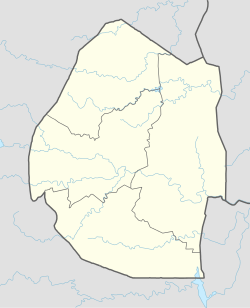 FDMH Location of the airport in Swaziland | |||||||||||
| Runways | |||||||||||
| |||||||||||
Mhlume Airfield (ICAO: FDMH) is an airstrip serving Mhlume, an agricultural town in the Lubombo Region of Swaziland. The runway is on the northwest corner of the town.
The Sikhuphe VOR-DME (Ident: VSK) is located 21.7 nautical miles (40.2 km) south of the airstrip. The Mhlume non-directional beacon (Ident: HL) is located on the field.[4]
See also
- Transport in Swaziland
- List of airports in Swaziland

References
- ↑ Airport information for Mhlume Airport at Great Circle Mapper.
- ↑ Google Maps - Mhlume
- ↑ "Mhlume Airport". SkyVector. Retrieved 18 June 2018.
- ↑ "Mhlume NDB, Sikhuphe VOR". SkyVector Aeronautical Charts. SkyVector. Retrieved 18 June 2018.
External links
- OpenStreetMap - Mhlume
- OurAirports - Mhlume
- FallingRain - Mhlume
- Accident history for Mhlume Airport at Aviation Safety Network
- Google Earth
| Main Roads |  | |
|---|---|---|
| Rail | ||
| Air | ||
| Border posts | ||
This article is issued from
Wikipedia.
The text is licensed under Creative Commons - Attribution - Sharealike.
Additional terms may apply for the media files.