Merta
| Merta | |
| Creek | |
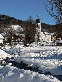 Merta in Vernířovice | |
| Country | Czech Republic |
|---|---|
| Region | Olomouc Region |
| District | Šumperk District |
| Source | |
| - elevation | 1,240 m (4,068 ft) |
| - coordinates | 50°4′2.5″N 17°10′11″E / 50.067361°N 17.16972°E |
| Mouth | |
| - elevation | 360 m (1,181 ft) |
| - coordinates | 50°0′12.4″N 17°1′30.2″E / 50.003444°N 17.025056°ECoordinates: 50°0′12.4″N 17°1′30.2″E / 50.003444°N 17.025056°E |
| Length | 16.6 km (10 mi) |
| Basin | 74.5 km2 (29 sq mi) |
| Discharge | |
| - average | 1.2 m3/s (42 cu ft/s) |
| Progression | Desná→ Morava→ Danube→ Black Sea |
Merta[1] (German: Merta Bach) is a creek in Šumperk District, Moravia, left right tributary of the Desná. Its length is 16,6 km and its drainage basin covers 74.5 km2. The mean annual discharge at its mouth is 1,20 m³/s.
The Merta originates from southeast slope of Vřesník peak in High Ash Mountains, 1200 meters above sea level.
Upper reaches have a character of mountain torrent flowing through steep meadows. Dead trees are in watercourse and banks keep its natural character.
Then The Merta goes through villages of Vernířovice, Sobotín and Petrov nad Desnou, where the creek is partially canalized. The Merta feeds two nameless pounds in Petrov nad Desnou, bigger has 0.5 ha, smaller one 0.3 ha.
References
This article is issued from
Wikipedia.
The text is licensed under Creative Commons - Attribution - Sharealike.
Additional terms may apply for the media files.