McKnightstown, Pennsylvania
| McKnightstown, Pennsylvania | |
|---|---|
| Census-designated place | |
 Keystone Marker | |
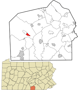 Location in Adams County and the state of Pennsylvania. | |
| Coordinates: 39°52′07″N 77°19′39″W / 39.86861°N 77.32750°WCoordinates: 39°52′07″N 77°19′39″W / 39.86861°N 77.32750°W | |
| Country | United States |
| State | Pennsylvania |
| County | Adams |
| Township | Franklin |
| Area | |
| • Total | 0.9 sq mi (2.3 km2) |
| • Land | 0.9 sq mi (2.3 km2) |
| • Water | 0 sq mi (0 km2) |
| Elevation | 640 ft (200 m) |
| Population (2010) | |
| • Total | 226 |
| • Density | 253/sq mi (97.8/km2) |
| Time zone | UTC-5 (Eastern (EST)) |
| • Summer (DST) | UTC-4 (EDT) |
| ZIP code | 17343[1] (established 1860) |
| FIPS code | 42-46312 |
| GNIS feature ID | 2630025[1] |
McKnightstown is a census-designated place (CDP) in Franklin Township, Adams County, Pennsylvania, United States.[1] It was formerly part of the Cashtown-McKnightstown CDP as of the 2000 census, and was then split into two separate CDPs for the 2010 census. As of the 2010 census the population was 226.[2]
The founder of the Eshelman manufacturing company was born in the town, and the 1919 Motor Transport Corps convoy travelled through the town on the Lincoln Highway before a modern highway bypassed the town in 1948-9.[3]
 House on Lincoln Highway at Flohr's Church Road
References
- 1 2 3 "McKnightstown Census Designated Place (2630025)". Geographic Names Information System. United States Geological Survey. Retrieved 2011-10-15.
- ↑ "Geographic Identifiers: 2010 Demographic Profile Data (G001): McKnightstown CDP, Pennsylvania". U.S. Census Bureau, American Factfinder. Retrieved July 29, 2013.
- ↑ "Route 30 Work Near Halfway Mark; West End Already Paved" (Google News Archive). Gettysburg Times. Gettysburg, Pennsylvania: Times and News Publishing Company. September 18, 1948. Retrieved 2011-10-25.
Municipalities and communities of Adams County, Pennsylvania, United States | ||
|---|---|---|
| Boroughs | 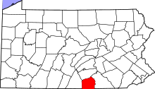 | |
| Townships | ||
| CDPs | ||
| Unincorporated communities | ||
| Ghost town | ||
This article is issued from
Wikipedia.
The text is licensed under Creative Commons - Attribution - Sharealike.
Additional terms may apply for the media files.