Hunterstown, Pennsylvania
| Hunterstown, Pennsylvania | |
|---|---|
| Census-designated place | |
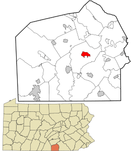 Location in Adams County and the state of Pennsylvania. | |
| Coordinates: 39°52′56″N 77°09′37″W / 39.88222°N 77.16028°WCoordinates: 39°52′56″N 77°09′37″W / 39.88222°N 77.16028°W | |
| Country | United States |
| State | Pennsylvania |
| County | Adams |
| Township | Straban |
| Area | |
| • Total | 1.73 sq mi (4.48 km2) |
| • Land | 1.73 sq mi (4.47 km2) |
| • Water | 0.004 sq mi (0.01 km2) |
| Elevation | 554 ft (169 m) |
| Population (2010) | |
| • Total | 547 |
| • Density | 317/sq mi (122.5/km2) |
| Time zone | UTC-5 (Eastern (EST)) |
| • Summer (DST) | UTC-4 (EDT) |
| Area code(s) | 717 |
| GNIS feature ID | 1177622[1] |
| FIPS code | 42-36352 |
Hunterstown is an unincorporated community and census-designated place in Straban Township, Adams County, Pennsylvania, United States. As of the 2010 census the population was 547.[2]
Hunterstown is located along Pennsylvania Route 394 (Shrivers Corner Road), 5 miles (8 km) northeast of Gettysburg.
The Hunterstown Historic District and Great Conewago Presbyterian Church are listed on the National Register of Historic Places.[3]
During the Battle of Gettysburg in 1863 there was a brief cavalry skirmish at Hunterstown.
References
- ↑ U.S. Geological Survey Geographic Names Information System: Hunterstown, Pennsylvania
- ↑ "Geographic Identifiers: 2010 Demographic Profile Data (G001): Hunterstown CDP, Pennsylvania". U.S. Census Bureau, American Factfinder. Retrieved July 19, 2013.
- ↑ National Park Service (2010-07-09). "National Register Information System". National Register of Historic Places. National Park Service.
External links
Municipalities and communities of Adams County, Pennsylvania, United States | ||
|---|---|---|
| Boroughs | 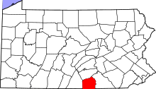 | |
| Townships | ||
| CDPs | ||
| Unincorporated communities | ||
| Ghost town | ||
This article is issued from
Wikipedia.
The text is licensed under Creative Commons - Attribution - Sharealike.
Additional terms may apply for the media files.