Mayetta, Kansas
| Mayetta, Kansas | |
|---|---|
| City | |
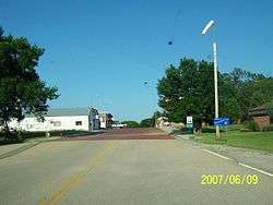 Downtown Mayetta (2007) | |
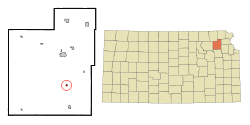 Location within Jackson County and Kansas | |
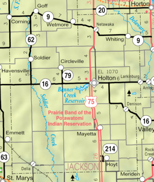 KDOT map of Jackson County (legend) | |
| Coordinates: 39°20′20″N 95°43′19″W / 39.33889°N 95.72194°WCoordinates: 39°20′20″N 95°43′19″W / 39.33889°N 95.72194°W | |
| Country | United States |
| State | Kansas |
| County | Jackson |
| Area[1] | |
| • Total | 0.17 sq mi (0.44 km2) |
| • Land | 0.17 sq mi (0.44 km2) |
| • Water | 0 sq mi (0 km2) |
| Elevation | 1,191 ft (363 m) |
| Population (2010)[2] | |
| • Total | 341 |
| • Estimate (2016)[3] | 337 |
| • Density | 2,000/sq mi (780/km2) |
| Time zone | UTC-6 (Central (CST)) |
| • Summer (DST) | UTC-5 (CDT) |
| ZIP code | 66509 |
| Area code | 785 |
| FIPS code | 20-45250 [4] |
| GNIS feature ID | 0478308 [5] |
Mayetta is a city in Jackson County, Kansas, United States. As of the 2010 census, the city population was 341.[6]
History
Mayetta was laid out and platted in 1886.[7] It was named for Mary Henrietta Lunger, the young daughter of the town's founder who had died some time before.[8][9]
The first post office in Mayetta was established in February 1886.[10]
Geography
Mayetta is located at 39°20′20″N 95°43′19″W / 39.33889°N 95.72194°W (39.338776, -95.721943).[11] According to the United States Census Bureau, the city has a total area of 0.17 square miles (0.44 km2), all of it land.[1]
Demographics
| Historical population | |||
|---|---|---|---|
| Census | Pop. | %± | |
| 1910 | 337 | — | |
| 1920 | 309 | −8.3% | |
| 1930 | 294 | −4.9% | |
| 1940 | 275 | −6.5% | |
| 1950 | 247 | −10.2% | |
| 1960 | 218 | −11.7% | |
| 1970 | 246 | 12.8% | |
| 1980 | 287 | 16.7% | |
| 1990 | 267 | −7.0% | |
| 2000 | 312 | 16.9% | |
| 2010 | 341 | 9.3% | |
| Est. 2016 | 337 | [3] | −1.2% |
| U.S. Decennial Census | |||
Mayetta is part of the Topeka, Kansas Metropolitan Statistical Area.
2010 census
As of the census[2] of 2010, there were 341 people, 125 households, and 85 families residing in the city. The population density was 2,005.9 inhabitants per square mile (774.5/km2). There were 131 housing units at an average density of 770.6 per square mile (297.5/km2). The racial makeup of the city was 82.1% White, 1.5% African American, 11.1% Native American, 0.3% from other races, and 5.0% from two or more races. Hispanic or Latino of any race were 2.1% of the population.
There were 125 households of which 43.2% had children under the age of 18 living with them, 42.4% were married couples living together, 16.8% had a female householder with no husband present, 8.8% had a male householder with no wife present, and 32.0% were non-families. 26.4% of all households were made up of individuals and 10.4% had someone living alone who was 65 years of age or older. The average household size was 2.73 and the average family size was 3.15.
The median age in the city was 32.5 years. 32.8% of residents were under the age of 18; 7% were between the ages of 18 and 24; 29.5% were from 25 to 44; 22.8% were from 45 to 64; and 7.6% were 65 years of age or older. The gender makeup of the city was 52.5% male and 47.5% female.
2000 census
As of the census[4] of 2000, there were 312 people, 111 households, and 75 families residing in the city. The population density was 1,888.7 people per square mile (708.6/km²). There were 121 housing units at an average density of 732.5 per square mile (274.8/km²). The racial makeup of the city was 80.77% White, 14.10% Native American, 0.32% from other races, and 4.81% from two or more races. Hispanic or Latino of any race were 0.96% of the population.
There were 111 households out of which 46.8% had children under the age of 18 living with them, 51.4% were married couples living together, 15.3% had a female householder with no husband present, and 32.4% were non-families. 24.3% of all households were made up of individuals and 9.9% had someone living alone who was 65 years of age or older. The average household size was 2.81 and the average family size was 3.40.
In the city, the population was spread out with 37.2% under the age of 18, 8.0% from 18 to 24, 31.4% from 25 to 44, 15.1% from 45 to 64, and 8.3% who were 65 years of age or older. The median age was 28 years. For every 100 females, there were 97.5 males. For every 100 females age 18 and over, there were 90.3 males.
The median income for a household in the city was $38,542, and the median income for a family was $43,500. Males had a median income of $25,313 versus $21,500 for females. The per capita income for the city was $14,800. About 2.4% of families and 3.9% of the population were below the poverty line, including 4.4% of those under age 18 and 4.5% of those age 65 or over.
Notable people
- Minnie Evans, leader of the Potawatomi Nation, was born in Mayetta.
- Bill James, baseball writer and expert grew up in Mayetta.
See also
References
- 1 2 "US Gazetteer files 2010". United States Census Bureau. Archived from the original on July 14, 2012. Retrieved 2012-07-06.
- 1 2 "American FactFinder". United States Census Bureau. Retrieved 2012-07-06.
- 1 2 "Population and Housing Unit Estimates". Retrieved June 9, 2017.
- 1 2 "American FactFinder". United States Census Bureau. Archived from the original on September 11, 2013. Retrieved 2008-01-31.
- ↑ "US Board on Geographic Names". United States Geological Survey. 2007-10-25. Retrieved 2008-01-31.
- ↑ "2010 City Population and Housing Occupancy Status". U.S. Census Bureau. Archived from the original on July 21, 2011. Retrieved March 17, 2012.
- ↑ Barr, Elizabeth N. (1907). Business directory and history of Jackson County. p. 70.
- ↑ Kansas State Historical Society (1916). Biennial Report of the Board of Directors of the Kansas State Historical Society. Kansas State Printing Plant. p. 207.
- ↑ Blackmar, Frank Wilson (1912). Kansas: A Cyclopedia of State History, Volume 2. Standard Publishing Company. p. 249.
- ↑ "Kansas Post Offices, 1828-1961 (archived)". Kansas Historical Society. Archived from the original on 9 October 2013. Retrieved 11 June 2014.
- ↑ "US Gazetteer files: 2010, 2000, and 1990". United States Census Bureau. 2011-02-12. Retrieved 2011-04-23.
External links
| Wikimedia Commons has media related to Mayetta, Kansas. |
- City
- Schools
- USD 337, local school district
- Maps
- Mayetta City Map, KDOT
Municipalities and communities of Jackson County, Kansas, United States | ||
|---|---|---|
| Cities |  | |
| Unincorporated communities | ||
| Indian reservations | ||
| Townships | ||
| Footnotes | ‡This populated place also has portions in an adjacent county or counties | |