Mayang Miao Autonomous County
| Mayang County 麻阳县 | |
|---|---|
| County | |
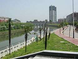 | |
 Mayang Location in Hunan | |
| Coordinates: 27°51′50″N 109°48′04″E / 27.864°N 109.801°ECoordinates: 27°51′50″N 109°48′04″E / 27.864°N 109.801°E[1] | |
| Country | People's Republic of China |
| Province | Hunan |
| Prefecture-level city | Huaihua |
| Area[2] | |
| • Total | 1,560.93 km2 (602.68 sq mi) |
| Population (2010)[3] | |
| • Total | 343,309 |
| • Density | 220/km2 (570/sq mi) |
| Time zone | UTC+8 (China Standard) |
| Postal code | 4194XX |
Mayang ( "Mayang Miao Autonomous County", simplified Chinese: 麻阳苗族自治县; traditional Chinese: 麻陽苗族自治縣; pinyin: Máyáng Miáozú Zìzhìxiàn; usually referred to as "Mayang County", simplified Chinese: 麻阳县; traditional Chinese: 麻陽縣; pinyin: Máyáng Xiàn) is an autonomous county of Miao people in Hunan Province, China, it is under the administration of Huaihua Prefecture-level City.
Mayang is located on the west central margin of Hunan Province, adjacent to Guizhou Province. It borders Bijiang District of Tongren, Guizhou to the west, Fenghuang County to the northwest, Luxi County to the northeast, Chenxi County and Hecheng District of Huaihua to the southeast, Zhijiang County to the south. The county covers 1,568.19 km2 (605.48 sq mi), as of 2015, It had a registered population of 403,400 and a resident population of 349,000.[4] The county has 7 towns and 11 townships under its jurisdiction, the county seat is Yaoli Community (高村镇尧里社区).[5]
Climate
| Climate data for Mayang (1981−2010) | |||||||||||||
|---|---|---|---|---|---|---|---|---|---|---|---|---|---|
| Month | Jan | Feb | Mar | Apr | May | Jun | Jul | Aug | Sep | Oct | Nov | Dec | Year |
| Record high °C (°F) | 26.1 (79) |
30.5 (86.9) |
35.0 (95) |
34.5 (94.1) |
36.2 (97.2) |
37.1 (98.8) |
39.5 (103.1) |
40.4 (104.7) |
39.4 (102.9) |
36.5 (97.7) |
31.8 (89.2) |
23.2 (73.8) |
40.4 (104.7) |
| Average high °C (°F) | 8.8 (47.8) |
11.1 (52) |
15.5 (59.9) |
21.9 (71.4) |
26.7 (80.1) |
29.7 (85.5) |
33.0 (91.4) |
33.2 (91.8) |
29.3 (84.7) |
22.9 (73.2) |
17.5 (63.5) |
11.7 (53.1) |
21.8 (71.2) |
| Daily mean °C (°F) | 5.4 (41.7) |
7.4 (45.3) |
11.2 (52.2) |
17.2 (63) |
21.8 (71.2) |
25.2 (77.4) |
28.3 (82.9) |
27.9 (82.2) |
24.0 (75.2) |
18.3 (64.9) |
12.9 (55.2) |
7.6 (45.7) |
17.3 (63.1) |
| Average low °C (°F) | 2.9 (37.2) |
4.9 (40.8) |
8.2 (46.8) |
13.7 (56.7) |
18.3 (64.9) |
22.0 (71.6) |
24.6 (76.3) |
24.1 (75.4) |
20.3 (68.5) |
15.1 (59.2) |
9.8 (49.6) |
4.7 (40.5) |
14.1 (57.3) |
| Record low °C (°F) | −3.8 (25.2) |
−3.6 (25.5) |
−0.3 (31.5) |
3.6 (38.5) |
9.0 (48.2) |
14.3 (57.7) |
17.9 (64.2) |
17.2 (63) |
12.7 (54.9) |
4.9 (40.8) |
−0.5 (31.1) |
−3.2 (26.2) |
−3.8 (25.2) |
| Average precipitation mm (inches) | 47.1 (1.854) |
57.5 (2.264) |
84.5 (3.327) |
139.0 (5.472) |
175.1 (6.894) |
214.5 (8.445) |
181.7 (7.154) |
94.4 (3.717) |
65.3 (2.571) |
98.8 (3.89) |
63.6 (2.504) |
35.0 (1.378) |
1,256.5 (49.47) |
| Average relative humidity (%) | 79 | 78 | 79 | 80 | 80 | 82 | 78 | 76 | 75 | 79 | 78 | 76 | 78 |
| Source: China Meteorological Data Service Center | |||||||||||||
References
- www.xzqh.org (in Chinese)
- ↑ Google (2014-07-02). "Mayang" (Map). Google Maps. Google. Retrieved 2014-07-02.
- ↑ Huaihua City Land Use Plan (2006–20)/《怀化市土地利用总体规划(2006-2020年)》.(in Chinese) Accessed 8 July 2014.
- ↑ "怀化市2010年第六次全国人口普查主要数据公报" (in Chinese). Huaihua Statistical Bureau/怀化市统计局. Archived from the original on 14 July 2014. Retrieved 9 July 2014.
- ↑ about the population of Mayang County in 2015, according to the Statistical Communiqué of Mayang County on the 2015 National Economic and Social Development - (2015年麻阳县国民经济和社会发展统计公报): http://www.mayang.gov.cn/Item/38864.aspx mayang.gov.cn] or ahmhxc.com
- ↑ the divisions of Mayang County in 2015, according to the result on adjustment of township-level administrative divisions of Mayang County on November 25, 2015 - 《湖南省民政厅关于同意麻阳县乡镇区划调整方案的批复》(湘民行发〔2015〕79号): rednet.cn, also see 《湖南省乡镇区划调整改革109个县市区批复方案》: people.com or xinhuanet.com
External links