Maxie, Virginia
| Maxie, Virginia | |
|---|---|
| Unincorporated community | |
 Maxie, Virginia  Maxie, Virginia | |
| Coordinates: 37°18′04″N 82°10′27″W / 37.30111°N 82.17417°WCoordinates: 37°18′04″N 82°10′27″W / 37.30111°N 82.17417°W | |
| Country | United States |
| State | Virginia |
| County | Buchanan |
| Elevation | 1,066 ft (325 m) |
| Time zone | UTC-5 (Eastern (EST)) |
| • Summer (DST) | UTC-4 (EDT) |
| Area code(s) | 276 |
| GNIS feature ID | 1495912[1] |
Maxie is an unincorporated community in Buchanan County, in the U.S. state of Virginia.
The Maxie post office was established in 1914.[2]
References
- ↑ U.S. Geological Survey Geographic Names Information System: Maxie, Virginia
- ↑ "Buchanan County". Jim Forte Postal History. Retrieved 28 September 2014.
Municipalities and communities of Buchanan County, Virginia, United States | ||
|---|---|---|
| Town | 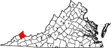 | |
| CDP | ||
| Unincorporated communities |
| |
| Footnotes | ‡This populated place also has portions in an adjacent county or counties | |
This article is issued from
Wikipedia.
The text is licensed under Creative Commons - Attribution - Sharealike.
Additional terms may apply for the media files.