Mauvilla, Alabama
| Mauvilla | |
|---|---|
| Unincorporated community | |
 Mauvilla Location within Alabama | |
| Coordinates: -AL_type:city_source:GNIS 30°50′13″N 088°11′04″W / 30.83694°N 88.18444°WCoordinates: -AL_type:city_source:GNIS 30°50′13″N 088°11′04″W / 30.83694°N 88.18444°W [1] | |
| Country | United States |
| State | Alabama |
| County | Mobile |
| Elevation[1] | 157 ft (48 m) |
| Time zone | UTC-6 (Central (CST)) |
| • Summer (DST) | UTC-5 (CDT) |
| Area code(s) | 251 |
| GNIS ID[1] | 122399 |
Mauvilla is an unincorporated community in Mobile County, Alabama, United States.[1][2] A post office operated under the name Mauvilla in 1856 and from 1895 to 1912.[3]
Geography
Mauvilla is located at 30°50′13″N 088°11′04″W / 30.83694°N 88.18444°W at an elevation of 157 feet (48 m).[1][2]
References
- 1 2 3 4 5 "Feature Detail Report for: Mauvilla (Mobile County, Alabama)". Geographic Names Information System. United States Geological Survey. Retrieved January 8, 2013.
- 1 2 "Mauvilla, Alabama". Alabama Home Town Locator. Retrieved March 9, 2008.
- ↑ "Mobile County". Jim Forte Postal History. Retrieved 16 March 2015.
Municipalities and communities of Mobile County, Alabama, United States | ||
|---|---|---|
| Cities | 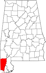 | |
| Towns | ||
| CDPs | ||
| Unincorporated communities | ||
| Ghost town | ||
| Footnotes | ‡This populated place also has portions in an adjacent county or counties | |
This article is issued from
Wikipedia.
The text is licensed under Creative Commons - Attribution - Sharealike.
Additional terms may apply for the media files.