Le Moyne, Alabama
| Le Moyne, Alabama | |
|---|---|
| Unincorporated community | |
 Le Moyne, Alabama Location within the state of Alabama  Le Moyne, Alabama Le Moyne, Alabama (the US) | |
| Coordinates: 30°57′29″N 88°1′40″W / 30.95806°N 88.02778°WCoordinates: 30°57′29″N 88°1′40″W / 30.95806°N 88.02778°W | |
| Country | United States |
| State | Alabama |
| County | Mobile |
| Elevation | 39 ft (12 m) |
| Time zone | UTC-6 (Central (CST)) |
| • Summer (DST) | UTC-5 (CDT) |
| Area code(s) | 251 |
Le Moyne is an unincorporated community in Mobile County, Alabama, United States.[1] It was named in honor of the Le Moyne brothers, Pierre Le Moyne d'Iberville and Jean-Baptiste Le Moyne, Sieur de Bienville, founders of colonial Mobile. Twenty-Seven Mile Bluff, on the Mobile River, is located in Le Moyne. The bluff is the site of the former Fort Louis de La Louisiane, capital of French Louisiana from 1702 until 1711.[2]
Geography
Le Moyne is located at 30°57′30″N 88°01′40″W / 30.95823°N 88.027776°W and has an elevation of 39 feet (12 m).[1]
References
- 1 2 U.S. Geological Survey Geographic Names Information System: Le Moyne, Alabama
- ↑ "Old Mobile Site Determined Eligible for Designation as a National Historic Landmark". Archived from the original on October 19, 2012. Retrieved 2010-04-24.
Municipalities and communities of Mobile County, Alabama, United States | ||
|---|---|---|
| Cities | 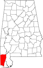 | |
| Towns | ||
| CDPs | ||
| Unincorporated communities | ||
| Ghost town | ||
| Footnotes | ‡This populated place also has portions in an adjacent county or counties | |
This article is issued from
Wikipedia.
The text is licensed under Creative Commons - Attribution - Sharealike.
Additional terms may apply for the media files.