Coden, Alabama
| Coden, Alabama | |
|---|---|
| Unincorporated community | |
 Coden, Alabama | |
 Coden, Alabama Location within the state of Alabama  Coden, Alabama Coden, Alabama (the US) | |
| Coordinates: 30°22′59″N 88°14′18″W / 30.38306°N 88.23833°WCoordinates: 30°22′59″N 88°14′18″W / 30.38306°N 88.23833°W | |
| Country | United States |
| State | Alabama |
| County | Mobile |
| Elevation | 7 ft (2 m) |
| Time zone | UTC-6 (Central (CST)) |
| • Summer (DST) | UTC-5 (CDT) |
| ZIP code | 36523 |
| Area code(s) | 251 |
Coden is an unincorporated community coastal fishing village in southern Mobile County, Alabama, United States. Located near Bayou la Batre, it lies across the Mississippi Sound from Dauphin Island.[1] The name of the town comes from Coq d'Inde, which is French for "Turkey".[2]
History
The name of the community is derived from Bayou Coden, the bayou that it is situated upon. Bayou Coden is an English translation of the original French name, Coq d' Inde.[1] Beginning in the late 1800s the area became known for its resorts, but a hurricane in 1906 ended the hotel business.[3]
Geography
Coden is located at 30°22′59″N 88°14′18″W / 30.38306°N 88.23833°W and has an elevation of 7 feet (2 m).[1]
References
- 1 2 3 U.S. Geological Survey Geographic Names Information System: Coden, Alabama
- ↑ "Coden, Alabama", Simple English Wikipedia, the free encyclopedia, 2016-09-30, retrieved 2018-06-26
- ↑ "Portersville Revival Group: Annual Letter". Portersville Revival Group. 2007. Retrieved 27 April 2010.
| Wikimedia Commons has media related to Coden, Alabama. |
Municipalities and communities of Mobile County, Alabama, United States | ||
|---|---|---|
| Cities | 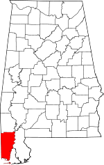 | |
| Towns | ||
| CDPs | ||
| Unincorporated communities | ||
| Ghost town | ||
| Footnotes | ‡This populated place also has portions in an adjacent county or counties | |
This article is issued from
Wikipedia.
The text is licensed under Creative Commons - Attribution - Sharealike.
Additional terms may apply for the media files.