Matola
| Matola | |
|---|---|
 Municipal Council of Matola | |
 Matola | |
| Coordinates: 25°57′44″S 32°27′32″E / 25.96222°S 32.45889°E | |
| Country |
|
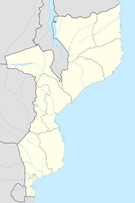
| Provinces | Maputo Province |
| Municipality | Matola |
| Area | |
| • Total | 373 km2 (144 sq mi) |
| Elevation | 3 m (10 ft) |
| Population (2017 census) | |
| • Total | 1,616,267 |
| • Density | 4,300/km2 (11,000/sq mi) |
| Climate | BSh |
Matola is the largest suburb of the Mozambique capital, Maputo, adjacent to its westernmost side. It is the nation's most populated city. Matola is the capital of Maputo Province and has had its own elected municipal government since 1998. It has a port and also the biggest industrial area in Mozambique. The population of Matola was, according to the 2007 census, 671,556 inhabitants,[1] having increased to a 2017 census population of 1,616,267.[2]
Etymology
Matola, which is also a common family name, comes from Matsolo a Ronga kingdom that existed in this region when the colonists arrived.
Industry
Matola is an industrial centre with an important port for minerals (chromium and iron) and other exports from Swaziland and South Africa. It has petroleum refineries (presently inactive) and diverse industries, which manufacture products like soap, cement, and agricultural materials. The most important of these is an aluminium smelter, installed in 2002, that more than doubled Mozambique's GDP. In November 2014, South Korean car company Hyundai Motor Company opened a plant in Matola, which manufactures the Hyundai i10 and Hyundai Accent.[3]
Transport
Matola is served by a station on the southern network of Mozambique Ports and Railways. Coal is exported from here.
Geography
Matola is also the name of a small river (some 30 km long), that makes the northern border of the Matola municipality, and flows into Maputo Bay.
Demographics
| Year (census) | Population[4] |
|---|---|
| 1997 | 424,662 |
| 2007 | 671,556 |
| 2017 | 1,616,267 |
Town twinning
See also
References
- ↑ "População por sexo e idade, segundo distrito Província de Maputo. 2007" (in Portuguese). Retrieved 2010-11-13.
- ↑ http://citypopulation.de/Mocambique.html
- ↑ "Partnership between Mozambique and South Korea Assembles Hyundai Cars". MacauHub. 2014-11-07. Retrieved 2015-01-04.
- ↑ "Mozambique: largest cities and towns and statistics of their population". World Gazetteer. Archived from the original on 2008-12-31. Retrieved 2008-06-18.
Coordinates: 25°58′S 32°28′E / 25.967°S 32.467°E
Provincial capitals of Mozambique | ||
|---|---|---|