Matale District
| Matale District මාතලේ දිස්ත්රික්කය மாத்தளை மாவட்டம் | |
|---|---|
| Administrative District | |
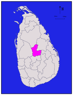 Map of Sri Lanka with Matale District highlighted | |
| Coordinates: 7°40′N 80°45′E / 7.667°N 80.750°ECoordinates: 7°40′N 80°45′E / 7.667°N 80.750°E | |
| Country | Sri Lanka |
| Province | Central Province |
| Largest city | Matale |
| Divisions |
List
|
| Government | |
| • District Secretary | D.P.G. Kumarasiri |
| • Local |
List
|
| Area | |
| • Total | 1,993 km2 (770 sq mi) |
| • Land | 1,952 km2 (754 sq mi) |
| • Water | 41 km2 (16 sq mi) |
| Population (2012)[1] | |
| • Total | 482,229 |
| • Density | 240/km2 (630/sq mi) |
| Time zone | UTC+05:30 (Sri Lanka) |
| ISO 3166 code | LK-22 |
| Website | ds.gov.lk/dist_matale |
Matale District (Sinhalese: මාතලේ දිස්ත්රික්කය, Tamil: மாத்தளை மாவட்டம்) is a district in Central Province, Sri Lanka. Its area is 1,987 km². The administrative capital of the district is the city of Matale.
Demographics
The population according to 2001 census is 441,328. 80.1% of the population are Sinhalese, 8.7% Sri Lankan Moors, 5.5% native Sri Lankan tamils and 5.3% tamils of Indian origin. 79% of the population are Buddhists, 9.6% Hindu, 9.1% Muslim and 2.3% Christian.[2]
Large towns
Small towns
Other places
Heritage Sites
List of other tourist attractions in Matale District
- Pitawala Pathana
- Hunnas Falls
- Sembuwatta Lake
- Riverstone
References
- 1 2 Department of Census and Statistics,The Census of Population and Housing of Sri Lanka-2011
- ↑ Department of Census and Statistics official government website
| Central Province | ||
|---|---|---|
| Eastern Province | ||
| North Central Province | ||
| Northern Province | ||
| North Western Province | ||
| Sabaragamuwa Province | ||
| Southern Province | ||
| Uva Province | ||
| Western Province | ||
This article is issued from
Wikipedia.
The text is licensed under Creative Commons - Attribution - Sharealike.
Additional terms may apply for the media files.