Maryland Route 281
| ||||
|---|---|---|---|---|
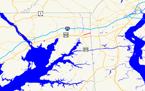 Maryland Route 281 highlighted in red | ||||
| Route information | ||||
| Maintained by MDSHA | ||||
| Length | 2.12 mi[1] (3.41 km) | |||
| Existed | 1933 – present | |||
| Major junctions | ||||
| West end |
| |||
|
| ||||
| East end | Old Baltimore Pike at the Delaware state line near Elkton | |||
| Location | ||||
| Counties | Cecil | |||
| Highway system | ||||
| ||||

Maryland Route 281 (MD 281) is a state highway in the U.S. state of Maryland. Known for most of its length as Red Hill Road, the state highway runs 2.12 miles (3.41 km) from MD 7 east to the Delaware state line in Elkton in northeastern Cecil County. MD 281 and its continuation in Delaware were originally blazed in the 18th century as part of the Old Post Road between Baltimore and Philadelphia. The route was part of the Elk and Christiana Turnpike in the early 19th century and later the Old Baltimore Pike, but it was replaced as the main highway east from Elkton by U.S. Route 40 (US 40) in the early 20th century. MD 281 was constructed in Elkton in the early 1930s. The highway designation was extended east to the state line in the late 1950s; that extension was reconstructed in the early 1960s.
Route description
_at_Maryland_State_Route_781_(Delancy_Road)_just_east_of_Elkton_in_Cecil_County%2C_Maryland.jpg)
MD 281 begins at an intersection with MD 7 in the town of Elkton. MD 7 continues west as Main Street and heads southeast as Delaware Avenue toward US 40. MD 281 heads east as two-lane Main Street and leaves the town by crossing Big Elk Creek. The highway continues as Red Hill Road, which passes to the north of Grays Hill. The road reaches a roundabout with Muddy Lane. MD 281 meets the northern end of MD 781 (Delancy Road) before reaching its eastern terminus at the Delaware state line. The highway continues straight as Old Baltimore Pike toward Christiana.[1][2]
History
What is now MD 281 and its continuation in Delaware was the Old Post Road used to connect Christiana Bridge with the head of the Elk River, and by extension Philadelphia and Baltimore, in the 18th century.[3] Alternatively known as Old Baltimore Pike, this road was part of the Washington–Rochambeau Revolutionary Route used by the French army in September 1781 during their march from Newport, Rhode Island, to Yorktown, Virginia, during the Revolutionary War.[4] In 1817, the Elk and Christiana Turnpike was completed along the path of the Old Post Road; the turnpike operated until 1838, when Old Baltimore Pike reverted to a public road.[3] By the 1920s, the Old Baltimore Pike was supplanted by a parallel highway to the south from Elkton to Wilmington that was chosen as the route of US 40.[5] The first segment of the modern MD 281 was constructed as a macadam road east from US 40 (now MD 7) on Main Street to Big Elk Creek between 1930 and 1933.[6][7] In 1948, the Maryland State Roads Commission, which at the time maintained the major county highways in Cecil County, reconstructed much of Red Hill Road as a gravel road in 1948 before it was to be given a hard surface.[8] The 1.77 miles (2.85 km) of highway from the west end of the Big Elk Creek bridge along Red Hill Road to the state line was transferred from county to state maintenance through a May 8, 1958, road transfer agreement.[9] MD 281 was reconstructed from Big Elk Creek to the state line in 1960 and 1961; this work included a new four-span, steel beam bridge across Big Elk Creek.[10] The highway was resurfaced with bituminous concrete from MD 7 to Big Elk Creek in 1968 and from the creek to Delaware in 1973.[11] In 2017, construction took place on a $3.1 million project to build a roundabout at Muddy Lane; this roundabout opened to traffic in October of that year.[12]
Junction list
The entire route is in Elkton, Cecil County.
| mi[1] | km | Destinations | Notes | ||
|---|---|---|---|---|---|
| 0.00 | 0.00 | Western terminus | |||
| 1.78 | 2.86 | ||||
| 2.12 | 3.41 | Old Baltimore Pike – Christiana | Delaware state line; eastern terminus | ||
| 1.000 mi = 1.609 km; 1.000 km = 0.621 mi | |||||
See also

References
- 1 2 3 Highway Information Services Division (December 31, 2014). Highway Location Reference. Maryland State Highway Administration. Retrieved 2010-10-13.
- Cecil County (PDF)
- ↑ Maryland State Highway Administration (2015). Maryland General Highway Statewide Grid Map (PDF) (Map). 1:12,000. Baltimore: Maryland State Highway Administration. § A16C. Retrieved July 13, 2016.
- 1 2 Pfingsten, Bill (2008-08-30). "Your Gateway to Pencader Heritage Marker". The Historical Marker Database. Bel Air, MD: J.J. Prats. Retrieved 2010-03-27.
- ↑ "W3R Heritage Tour in Delaware". Washington-Rochambeau Revolutionary Route. The National Washington-Rochambeau Revolutionary Route Association, Inc. 2008-04-17. Retrieved 2010-03-27.
- ↑ Maryland Geological Survey (1927). Map of Maryland: Showing State Road System and State Aid Roads (Map). Baltimore: Maryland Geological Survey.
- ↑ Maryland Geological Survey (1930). Map of Maryland Showing State Road System: State Aid Roads and Improved County Road Connections (Map). Baltimore: Maryland Geological Survey.
- ↑ Maryland Geological Survey (1933). Map of Maryland Showing State Road System: State Aid Roads and Improved County Road Connections (Map). Baltimore: Maryland Geological Survey.
- ↑ "Excerpt from Minutes of Meeting of the State Roads Commission" (PDF). S.R.C. Minutes District No. 2 Cecil County. Baltimore: Maryland State Roads Commission. December 15, 1948. Retrieved July 15, 2016 – via Maryland State Archives.
- ↑ "Excerpt from Minutes of Meeting of the State Roads Commission" (PDF). S.R.C. Minutes District No. 2 Cecil County. Baltimore: Maryland State Roads Commission. May 8, 1958. Retrieved July 15, 2016 – via Maryland State Archives.
- ↑ Maryland Road Construction Progress Log (PDF). Baltimore: Maryland State Highway Administration. Contract Numbers: CE-413-2-220 (January 12, 1960), CE-413-1-220 (April 12, 1960). Retrieved July 15, 2016 – via Maryland State Archives.
- ↑ Maryland Road Construction Progress Log (PDF). Baltimore: Maryland State Highway Administration. Contract Numbers: CE-483-214 (June 25, 1968), CE-531-214 (July 18, 1972). Retrieved July 15, 2016 – via Maryland State Archives.
- ↑ Iannetta, Jessica (October 25, 2017). "Muddy Lane intersection to reopen Monday". Cecil Whig. Retrieved April 7, 2018.
External links
| Wikimedia Commons has media related to Maryland Route 281. |
Route map: