Martinsville Township, Clark County, Illinois
| Martinsville Township | |
|---|---|
| Township | |
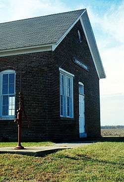 The Lincoln School Museum, north of Martinsville: Once a one-room schoolhouse, it is now a museum showcasing primary education of the late 19th century. | |
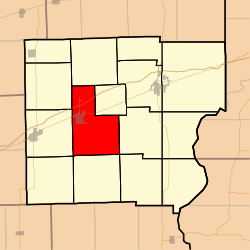 Location in Clark County | |
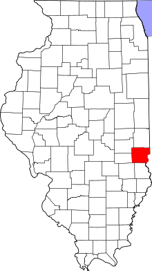 Clark County's location in Illinois | |
| Coordinates: 39°19′21″N 87°51′22″W / 39.32250°N 87.85611°WCoordinates: 39°19′21″N 87°51′22″W / 39.32250°N 87.85611°W | |
| Country | United States |
| State | Illinois |
| County | Clark |
| Established | November 7, 1854 |
| Area | |
| • Total | 41.82 sq mi (108.3 km2) |
| • Land | 41.67 sq mi (107.9 km2) |
| • Water | 0.15 sq mi (0.4 km2) 0.36% |
| Elevation | 643 ft (196 m) |
| Population (2010) | |
| • Estimate (2016)[1] | 1,559 |
| • Density | 38.4/sq mi (14.8/km2) |
| Time zone | UTC-6 (CST) |
| • Summer (DST) | UTC-5 (CDT) |
| ZIP code | 62442 |
| FIPS code | 17-023-47267 |
Martinsville Township is one of fifteen townships in Clark County, Illinois, USA. As of the 2010 census, its population was 1,602 and it contained 777 housing units.[2]
Geography
According to the 2010 census, the township has a total area of 41.82 square miles (108.3 km2), of which 41.67 square miles (107.9 km2) (or 99.64%) is land and 0.15 square miles (0.39 km2) (or 0.36%) is water.[2]
Cities, towns, villages
Unincorporated towns
(This list is based on USGS data and may include former settlements.)
Cemeteries
The township contains these six cemeteries: Island Grove, Kettering, Lincoln, Mount Pleasant, Baird and Rupp.
Major highways
Demographics
| Historical population | |||
|---|---|---|---|
| Census | Pop. | %± | |
| Est. 2016 | 1,559 | [1] | |
| U.S. Decennial Census[3] | |||
School districts
- Casey-Westfield Community Unit School District 4C
- Martinsville Community Unit School District 3C
Political districts
- Illinois' 15th congressional district
- State House District 109
- State Senate District 55
References
- "Martinsville Township, Clark County, Illinois". Geographic Names Information System. United States Geological Survey. Retrieved 2010-01-10.
- United States Census Bureau 2007 TIGER/Line Shapefiles
- United States National Atlas
- 1 2 "Population and Housing Unit Estimates". Retrieved June 9, 2017.
- 1 2 "Population, Housing Units, Area, and Density: 2010 - County -- County Subdivision and Place -- 2010 Census Summary File 1". United States Census. Retrieved 2013-05-28.
- ↑ "Census of Population and Housing". Census.gov. Retrieved June 4, 2016.
External links
Places adjacent to Martinsville Township, Clark County, Illinois | |
|---|---|
Municipalities and communities of Clark County, Illinois, United States | ||
|---|---|---|
| Cities | ||
| Town | ||
| Townships | ||
| CDP | ||
| Unincorporated communities | ||
| Ghost town | ||
| Footnotes | ‡This populated place also has portions in an adjacent county or counties | |
This article is issued from
Wikipedia.
The text is licensed under Creative Commons - Attribution - Sharealike.
Additional terms may apply for the media files.