Marivan County
| Marivan County شهرستان مریوان | |
|---|---|
| County | |
.svg.png) Counties of Kurdistan Province | |
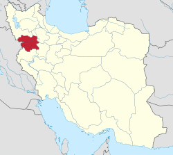 Location of Kurdistan Province in Iran | |
| Coordinates: 35°35′N 46°15′E / 35.583°N 46.250°ECoordinates: 35°35′N 46°15′E / 35.583°N 46.250°E | |
| Country |
|
| Province | Kurdistan Province |
| Capital | Marivan |
| Bakhsh (Districts) | Central District, Khav and Mirabad District, Sarshiv District |
| Population (2016) | |
| • Total | 195 262 |
| Time zone | UTC+3:30 (IRST) |
| • Summer (DST) | UTC+4:30 (IRDT) |
| Marivan County can be found at GEOnet Names Server, at this link, by opening the Advanced Search box, entering "9206644" in the "Unique Feature Id" form, and clicking on "Search Database". | |
Marivan County (Persian: شهرستان مریوان, Kurdish: شارستانی مەریوان) is a county in Kordestan Province in Iran. The capital of the county is Marivan. The county is subdivided into three districts: the Central District, Khav and Mirabad District, and Sarshiv District. The county has three cities: Marivan, Chenareh, Bardeh Rasheh and Kani Dinar. Marivan County is bordered by Saqqez County to the north, Sanandaj County to the east and southeast, Paveh County to the south, and Iraq to the west and northwest.
Demographics
At the time of the 2016 Population and Housing census the population of Marivan County was 195 263.[1] Of these, 151 188 lived in urban centres while 44 075 lived in rural regions. 99 956 were male and 95 307 were female. The county is the third most populous in Kurdestan province.[2]
Political Regions
According to the last series of subdivisions in 2011, Marivan County is divided into three cities, three districts, six rural areas and 176 villages, of which 151 are currently inhabited and 25 have been abandoned.[3]
Until 1958 the county was known as "Marivan District" and was one of the districts of Sanandaj County. At that time, Kalatrazan District, Sarvabad County, and Sarshiv District were considered to be parts of Marivan District. With the removal of Kaltrazan and Sarvabad, Marivan County was divided into a Central District, Sarshiv, and Khav and Mirabad District.
| Population pyramid 2011 [4] | ||||
| % | Males | Age | Females | % |
| 0.1 | 85+ | 0.1 | ||
| 0.4 | 80–84 | 0.3 | ||
| 0.6 | 75–79 | 0.5 | ||
| 0.5 | 70–74 | 0.5 | ||
| 0.7 | 65–69 | 0.6 | ||
| 1.0 | 60–64 | 1.2 | ||
| 1.4 | 55–59 | 1.4 | ||
| 1.6 | 50–54 | 1.6 | ||
| 2.1 | 45–49 | 2.1 | ||
| 3.3 | 40–44 | 3.2 | ||
| 4.1 | 35–39 | 3.8 | ||
| 4.9 | 30–34 | 4.3 | ||
| 5.6 | 25–29 | 5.5 | ||
| 5.7 | 20–24 | 6.1 | ||
| 5.3 | 15–19 | 5.2 | ||
| 4.1 | 10–14 | 4.0 | ||
| 4.5 | 5–9 | 4.3 | ||
| 4.9 | 0–4 | 4.7 | ||
Subdivisions
- Khav and Mirabad District
- Central Marivan District
- City of Marivan
- Sarshiv District
- City of Chenareh
References
- ↑ "Census of the Islamic Republic of Iran, 1395 (2016)" (Excel). Islamic Republic of Iran. (in Persian)
- ↑ "2016 Population and Housing Census" (in Persian). Iranian Centre of Demographics.
- ↑ "2011 National Subdivisions" (in Persian).
- ↑ "Results of the 2011 Population and Housing Census, by Age" (in Persian). National Department of Iranian Demographics. Archived from the original on 2014-06-28.
- اطلس گیتاشناسی استانهای ایران [Atlas Gitashenasi Ostanhai Iran] (Gitashenasi Province Atlas of Iran)
| Capital | 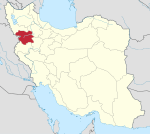 | ||||||||||||||||||||
|---|---|---|---|---|---|---|---|---|---|---|---|---|---|---|---|---|---|---|---|---|---|
| Counties and cities |
| ||||||||||||||||||||
| Sights |
| ||||||||||||||||||||
| populated places | |||||||||||||||||||||