Marion Township, Decatur County, Indiana
| Marion Township | |
|---|---|
| Township | |
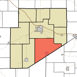 Location of Marion Township in Decatur County | |
| Coordinates: 39°14′30″N 85°27′09″W / 39.24167°N 85.45250°WCoordinates: 39°14′30″N 85°27′09″W / 39.24167°N 85.45250°W | |
| Country | United States |
| State | Indiana |
| County | Decatur |
| Government | |
| • Type | Indiana township |
| Area | |
| • Total | 55.54 sq mi (143.8 km2) |
| • Land | 55.48 sq mi (143.7 km2) |
| • Water | 0.06 sq mi (0.2 km2) |
| Elevation[1] | 906 ft (276 m) |
| Population (2010) | |
| • Total | 1,638 |
| • Density | 29.5/sq mi (11.4/km2) |
| FIPS code | 18-46872[2] |
| GNIS feature ID | 453604 |
Marion Township is one of nine townships in Decatur County, Indiana. As of the 2010 census, its population was 1,638 and it contained 667 housing units.[3]
History
Marion Township was organized in 1831.[4]
Geography
According to the 2010 census, the township has a total area of 55.54 square miles (143.8 km2), of which 55.48 square miles (143.7 km2) (or 99.89%) is land and 0.06 square miles (0.16 km2) (or 0.11%) is water.[3]
Cities and towns
Unincorporated towns
(This list is based on USGS data and may include former settlements.)
Adjacent townships
- Washington Township (north)
- Salt Creek Township (northeast)
- Jackson Township, Ripley County (southeast)
- Columbia Township, Jennings County (south)
- Sand Creek Township (west)
Major highways
Cemeteries
The township contains four cemeteries: Antioch, Burks Chapel, Mount Pleasant, and Immaculate Conception Catholic Cemetery.
References
- ↑ "US Board on Geographic Names". United States Geological Survey. 2007-10-25. Retrieved 2008-01-31.
- ↑ "American FactFinder". United States Census Bureau. Retrieved 2008-01-31.
- 1 2 "Population, Housing Units, Area, and Density: 2010 - County -- County Subdivision and Place -- 2010 Census Summary File 1". United States Census. Retrieved 2013-05-10.
- ↑ Harding, Lewis Albert (1915). History of Decatur County, Indiana: Its People, Industries and Institutions. B.F. Bowen. p. 95.
External links
Municipalities and communities of Decatur County, Indiana, United States | ||
|---|---|---|
| City | ||
| Towns | ||
| Townships | ||
| CDPs | ||
| Other unincorporated communities |
| |
| Ghost town | ||
| Footnotes | ‡This populated place also has portions in an adjacent county or counties | |
This article is issued from
Wikipedia.
The text is licensed under Creative Commons - Attribution - Sharealike.
Additional terms may apply for the media files.