Clay Township, Decatur County, Indiana
| Clay Township | |
|---|---|
| Township | |
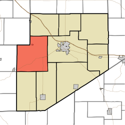 Location of Clay Township in Decatur County | |
| Coordinates: 39°18′46″N 85°37′09″W / 39.31278°N 85.61917°WCoordinates: 39°18′46″N 85°37′09″W / 39.31278°N 85.61917°W | |
| Country | United States |
| State | Indiana |
| County | Decatur |
| Government | |
| • Type | Indiana township |
| Area | |
| • Total | 50.72 sq mi (131.4 km2) |
| • Land | 50.65 sq mi (131.2 km2) |
| • Water | 0.06 sq mi (0.2 km2) |
| Elevation[1] | 830 ft (253 m) |
| Population (2010) | |
| • Total | 1,287 |
| • Density | 25.4/sq mi (9.8/km2) |
| FIPS code | 18-13042[2] |
| GNIS feature ID | 453208 |
Clay Township is one of nine townships in Decatur County, Indiana. As of the 2010 census, its population was 1,287 and it contained 535 housing units.[3]
History
Clay Township was organized in 1836.[4]
Champ's Ford Bridge was added to the National Register of Historic Places in 2009.[5]
Geography
According to the 2010 census, the township has a total area of 50.72 square miles (131.4 km2), of which 50.65 square miles (131.2 km2) (or 99.86%) is land and 0.06 square miles (0.16 km2) (or 0.12%) is water.[3]
Unincorporated towns
(This list is based on USGS data and may include former settlements.)
Adjacent townships
- Adams Township (northeast)
- Washington Township (east)
- Sand Creek Township (southeast)
- Jackson Township (south)
- Clifty Township, Bartholomew County (southwest)
- Haw Creek Township, Bartholomew County (west)
- Noble Township, Shelby County (northwest)
Major highways
Cemeteries
The township contains seven cemeteries: Center Grove, Columbia, Mowery, Nauvoo, Patrick, Pumphrey and Swinney.
References
- "Clay Township, Decatur County, Indiana". Geographic Names Information System. United States Geological Survey. Retrieved 2009-09-24.
- United States Census Bureau cartographic boundary files
- ↑ "US Board on Geographic Names". United States Geological Survey. 2007-10-25. Retrieved 2008-01-31.
- ↑ "American FactFinder". United States Census Bureau. Archived from the original on 2013-09-11. Retrieved 2008-01-31.
- 1 2 "Population, Housing Units, Area, and Density: 2010 - County -- County Subdivision and Place -- 2010 Census Summary File 1". United States Census. Retrieved 2013-05-10.
- ↑ Harding, Lewis Albert (1915). History of Decatur County, Indiana: Its People, Industries and Institutions. B.F. Bowen. p. 95.
- ↑ National Park Service (2010-07-09). "National Register Information System". National Register of Historic Places. National Park Service.
External links
Municipalities and communities of Decatur County, Indiana, United States | ||
|---|---|---|
| City | ||
| Towns | ||
| Townships | ||
| CDPs | ||
| Other unincorporated communities |
| |
| Ghost town | ||
| Footnotes | ‡This populated place also has portions in an adjacent county or counties | |
This article is issued from
Wikipedia.
The text is licensed under Creative Commons - Attribution - Sharealike.
Additional terms may apply for the media files.