Clay Township, Michigan
| Clay Township, Michigan | |
|---|---|
| Township | |
 Clay Township, Michigan Location within the state of Michigan | |
| Coordinates: 42°36′38″N 82°35′31″W / 42.61056°N 82.59194°WCoordinates: 42°36′38″N 82°35′31″W / 42.61056°N 82.59194°W | |
| Country | United States |
| State | Michigan |
| County | St. Clair |
| Area | |
| • Total | 82.5 sq mi (213.7 km2) |
| • Land | 35.5 sq mi (91.8 km2) |
| • Water | 47.1 sq mi (121.9 km2) |
| Elevation | 577 ft (176 m) |
| Population (2000) | |
| • Total | 9,822 |
| • Density | 277.0/sq mi (106.9/km2) |
| Time zone | UTC-5 (Eastern (EST)) |
| • Summer (DST) | UTC-4 (EDT) |
| ZIP code |
48001 (Algonac, 48028 (Harsens Island), 48039 (Marine City |
| FIPS code | 26-16180[1] |
| GNIS feature ID | 1626090[2] |
Clay Township is a civil township of St. Clair County in the U.S. state of Michigan. As of the 2000 census, the township population was 9,822. The township includes the inhabited Harsens Island.
Communities
- Pearl Beach is an area within the township, defined as a census-designated place (CDP) for statistical purposes by the U.S. Census Bureau.
- Pointe aux Tremble is an Unincorporated community within the Pearl Beach CDP.
- Perch Point is an unincorporated community on the boundary with Ira Township.
A number of an unincorporated communities are located on Harsens Island:
- Bedore is south along Bates Highway/S. Channel Drive (42°33′28″N 82°36′47″W / 42.55778°N 82.61306°W) between Forster and Clays Landing. (Elevation: 571 ft./174 m.)[3]
- Clays Landing is where M-154 turns in to S. Channel Drive (42°33′06″N 82°36′16″W / 42.55167°N 82.60444°W). (Elevation: 574 ft./175 m.)[4]
- Forster is south along Bates Highway/S. Channel Drive (42°33′40″N 82°37′06″W / 42.56111°N 82.61833°W). (Elevation: 577 ft./176 m.)[5]
- Grande Pointe is on the northeast end of the Island between N. Channel Drive and S. Channel Drive (42°35′58″N 82°32′43″W / 42.59944°N 82.54528°W). (Elevation: 577 ft. /176 m.) [6]
- Maple Leaf is on St. Clair River (east) shore between Volkes Road and Bar Harbor (42°35′58″N 82°32′43″W / 42.59944°N 82.54528°W) just south of Sans Souci. (Elevation: 577 ft. /176 m.)[7]
- Miller is at the end of Bates Highway where it becomes only S. Channel Drive (42°32′57″N 82°39′32″W / 42.54917°N 82.65889°W). (Elevation: 577 ft./176 m.) [8]
- Muirs is on M-154 south of Maple Leaf.[9]
- Sans Souci, is the town on Harsens Island, which is on the St. Clair River or South Channel (east) side of the Island (42°34′45″N 82°33′51″W / 42.57917°N 82.56417°W).[10]
Geography
According to the United States Census Bureau, the township has a total area of 82.5 square miles (214 km2), of which 35.5 square miles (92 km2) is land and 47.1 square miles (122 km2) (57.03%) is water. The 37-square-mile (96 km2) township includes Harsens Island, Russell Island, Dickinson Island and St. Johns Marsh.[12]
Demographics
As of the census[1] of 2000, there were 9,822 people, 3,934 households, and 2,844 families residing in the township. The population density was 277.0 per square mile (106.9/km²). There were 5,325 housing units at an average density of 150.2 per square mile (58.0/km²). The racial makeup of the township was 97.92% White, 0.20% African American, 0.68% Native American, 0.11% Asian, 0.21% from other races, and 0.87% from two or more races. Hispanic or Latino of any race were 0.85% of the population.
There were 3,934 households out of which 27.9% had children under the age of 18 living with them, 61.3% were married couples living together, 7.0% had a female householder with no husband present, and 27.7% were non-families. 22.9% of all households were made up of individuals and 9.2% had someone living alone who was 65 years of age or older. The average household size was 2.50 and the average family size was 2.94.
In the township the population was spread out with 22.6% under the age of 18, 6.5% from 18 to 24, 28.2% from 25 to 44, 28.8% from 45 to 64, and 13.9% who were 65 years of age or older. The median age was 41 years. For every 100 females, there were 103.6 males. For every 100 females age 18 and over, there were 103.2 males.
The median income for a household in the township was $55,059, and the median income for a family was $63,182. Males had a median income of $48,053 versus $31,923 for females. The per capita income for the township was $27,169. About 2.3% of families and 4.7% of the population were below the poverty line, including 6.7% of those under age 18 and 3.6% of those age 65 or over.
Clay Township Park
The Clay Township Park is located on Pte Tremble Rd. right next to the Clay Township offices and Police Dept. The park sees a flurry of activity from the children on the playground and the water splash pad, impromptu volleyball games and citizens enjoying the walking paths. The park also features a basketball court that is flooded in the winter to become an ice rink and walking trail. It is lighted to facilitate evening accessibility. A concession building and restroom facilities are also available.
[13] References
- 1 2 "American FactFinder". United States Census Bureau. Archived from the original on 2013-09-11. Retrieved 2008-01-31.
- ↑ U.S. Geological Survey Geographic Names Information System: Clay Township, Michigan
- ↑ U.S. Geological Survey Geographic Names Information System: Bedore, Michigan
- ↑ U.S. Geological Survey Geographic Names Information System: Clays Landing, Michigan & GNIS in Google Map
- ↑ U.S. Geological Survey Geographic Names Information System: Forster, Michigan & GNIS in Google Map
- ↑ U.S. Geological Survey Geographic Names Information System: Grande Pointe, Michigan & GNIS in Google Map
- ↑ U.S. Geological Survey Geographic Names Information System: Maple Leaf, Michigan & GNIS in Google Map
- ↑ U.S. Geological Survey Geographic Names Information System: Miller, Michigan & GNIS in Google Map
- ↑ U.S. Geological Survey Geographic Names Information System: Muirs, Michigan & GNIS in Google Map
- ↑ U.S. Geological Survey Geographic Names Information System: Sans Souci, Michigan & GNIS in Google Map
- ↑ "St. Clair County" (PDF). County Maps. Michigan Department of Technology, Management, and Budget. Retrieved 1 February 2012.
- ↑ Clay Township
- ↑ "Clay Township Park". www.claytownship.org. Retrieved 2017-07-08.
External links
Places adjacent to Clay Township, Michigan | |
|---|---|
Municipalities and communities of St. Clair County, Michigan, United States | ||
|---|---|---|
| Cities | 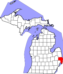 | |
| Villages | ||
| Charter townships | ||
| General law townships | ||
| CDP | ||
| Other unincorporated communities |
| |
| Footnotes | ‡This populated place also has portions in an adjacent county or counties | |