Manternach
| Manternach Manternach | ||
|---|---|---|
| Commune | ||
 | ||
| ||
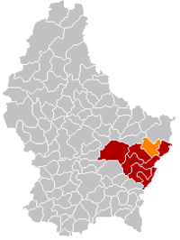 Map of Luxembourg with Manternach highlighted in orange, and the canton in dark red | ||
| Coordinates: 49°42′25″N 6°25′25″E / 49.7069°N 6.4236°ECoordinates: 49°42′25″N 6°25′25″E / 49.7069°N 6.4236°E | ||
| Country |
| |
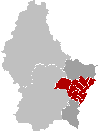
| Canton | Grevenmacher | |
| Government | ||
| • Mayor | Henri Frank | |
| Area | ||
| • Total | 27.68 km2 (10.69 sq mi) | |
| Area rank | 28 of 102 | |
| Highest elevation | 341 m (1,119 ft) | |
| • Rank | 90th of 102 | |
| Lowest elevation | 181 m (594 ft) | |
| • Rank | 18th of 102 | |
| Population (2014) | ||
| • Total | 1,886 | |
| • Rank | 70th of 102 | |
| • Density | 68/km2 (180/sq mi) | |
| • Density rank | 79th of 102 | |
| Time zone | UTC+1 (CET) | |
| • Summer (DST) | UTC+2 (CEST) | |
| LAU 2 | LU00007006 | |
| Website | manternach.lu | |

Manternach is a commune and small town in eastern Luxembourg. It is part of the canton of Grevenmacher, which is part of the district of Grevenmacher.
As of 2001, the town of Manternach, which lies in the south of the commune, has a population of 417. Other towns within the commune include Berbourg, Lellig, and Munschecker.
Manternach railway station has regular services directly to Luxembourg railway station in Luxembourg city and Wasserbillig.
Image gallery
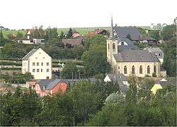
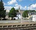 Manternach, seen from the railway station
External links

Places adjacent to Manternach | ||||||||||
|---|---|---|---|---|---|---|---|---|---|---|
| ||||||||||
 | ||
This article is issued from
Wikipedia.
The text is licensed under Creative Commons - Attribution - Sharealike.
Additional terms may apply for the media files.