Mangshi River
| Mangshi River 芒市河 | |
|---|---|
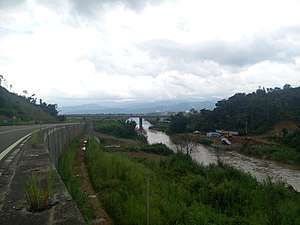 Mangshi River at Fengping Town | |
| Physical characteristics | |
| Main source |
Jingzhuping Village in Longxin Township, Longling County, Baoshan[1] 2,235 m |
| River mouth |
Gazhong Village in Gazhong Town, Mangshi, Dehong Dai and Jingpo Autonomous Prefecture 783 m 24°10′09″N 98°07′32″E / 24.1691°N 98.1255°ECoordinates: 24°10′09″N 98°07′32″E / 24.1691°N 98.1255°E |
| Length | 117.1 km |
| Discharge |
|
| Basin features | |
| River system | Irrawaddy River |
| Basin size | 1,881 km² |
| Population | 0.29 millions(2004)[1] |
Mangshi River (Chinese: 芒市河) also called Mangshi Large River (Chinese: 芒市大河), is a river in western Yunnan, mainly in the territory of Mangshi City. It is the largest tributary river of Shweli River in China, which is a tributary river of Irrawaddy. The source of Mangshi River is at Longxin Township in Longling County, Baoshan, and the upper also called Bawan River (Chinese: 八湾河). Mangshi River flow through the west fields of Mangshi city, and it flow in Shweli River at Gazhong Village (Chinese: 戛中村) in Zhefang Town. It is the mother river of Mangshi[2]. The length of Mangshi River is 117.1 km, and the basin size is 1,881 km², about 61.3% of area of Mangshi City. [1][3][4][5]
References
- 1 2 3 敬正书; 《中国河湖大典》编纂委员会 (2010). 《中国河湖大典 西南诸河卷》. Beijing: China Water&Power Press. p. 90-91. ISBN 978-7-5170-2699-0.
- ↑ "Mangshi River". en.dehong.gov.cn. Dehong.Gov. 2013-09-24. Retrieved 2018-05-21.
- ↑ 牛汝辰 (1995). 《中国水名词典》. Harbin: Harbin Map Publisher. p. 170. ISBN 7-80529-266-3.
- ↑ 吴志湘; 德宏傣族景颇族自治州志编纂委员会 (1994). 《德宏州志 综合卷》. Mangshi: Dehong National Publisher. p. 118. ISBN 978-7-8052-5248-3.
- ↑ 何萍; 潞西县志编纂委员会 (1993). 《潞西县志》. Kunming: Yunnan Education Publishing House. p. 59. ISBN 978-7-5415-0685-7.
This article is issued from
Wikipedia.
The text is licensed under Creative Commons - Attribution - Sharealike.
Additional terms may apply for the media files.