Manatuto
| Manatuto | |
|---|---|
| Town | |
 | |
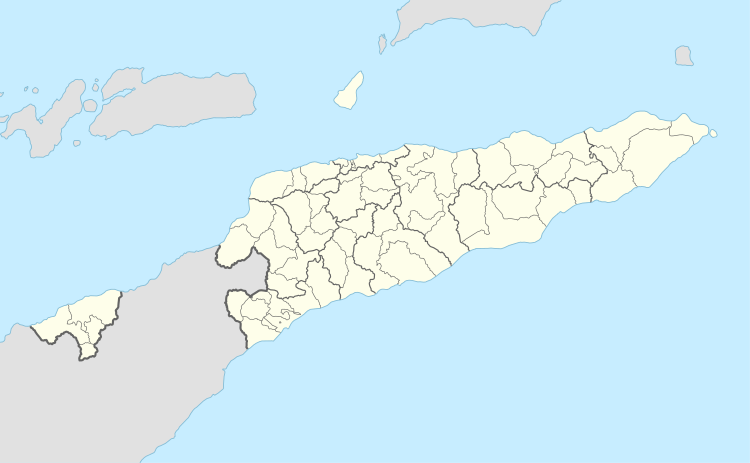 Manatuto Location in East Timor | |
| Coordinates: 8°30′44″S 126°00′57″E / 8.51222°S 126.01583°ECoordinates: 8°30′44″S 126°00′57″E / 8.51222°S 126.01583°E | |
| Country |
|
| Municipality | Manatuto |
| Administrative post | Manatuto |
| Area | |
| • Total | 271.38 km2 (104.78 sq mi) |
| Elevation | 0 m (0 ft) |
| Population (2010) | |
| • Total | 3,692 |
| • Density | 14/km2 (35/sq mi) |
| Time zone | UTC+09:00 (TLT) |
| Climate | BSh |
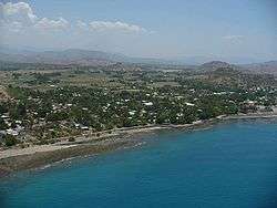
Manatuto is a city of Manatuto District, East Timor.
Manatuto Vila has 3,692 inhabitants (Census 2015) and is capital of the subdistrict and district Manatuto. It is on the north coast of Timor, located 64 km to the east of Dili, the national capital, on the way to Baucau. The capital is known for its salt production and abundance of tamarind.
The town of Manatuto suffered an excessive amount of damage and high murder rate in 1999 compared to other locations. The town is still being re-built.
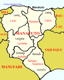 Map of Manatuto district
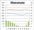 Climate[1]
References
External links
![]()
Capitals of Municipalities of East Timor | ||
|---|---|---|
This article is issued from
Wikipedia.
The text is licensed under Creative Commons - Attribution - Sharealike.
Additional terms may apply for the media files.