Malay Falls, Nova Scotia
| Malay Falls, Nova Scotia | |
|---|---|
| Rural Community | |
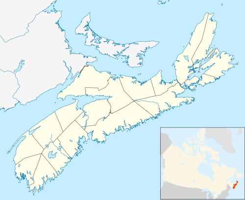 Malay Falls, Nova Scotia Location in Nova Scotia | |
| Coordinates: 44°58′29.8″N 62°28′59.4″W / 44.974944°N 62.483167°WCoordinates: 44°58′29.8″N 62°28′59.4″W / 44.974944°N 62.483167°W | |
| Country | Canada |
| Province | Nova Scotia |
| Municipality | Halifax Regional Municipality |
| Community Council | Harbour East - Marine Drive Community Council |
| District | District 2 Preston - Chezzetcook - Eastern Shore |
| Government | |
| • Type | Municipal |
| • Mayor | Mike Savage |
| • Councillor | David Hendsbee |
| Time zone | UTC-4 (Atlantic Standard Time) |
| • Summer (DST) | UTC-3 (Atlantic Daylight Saving Time) |
| Canadian postal code | B0J 3B0 |
| North American Area Code | 902 |
| GNBC Code | CAXHX |
| NTS Map | 011D16 |
| Weather Station Code | CXMY |
| Rural Route | RR 2 |
| Highway |
|
Malay Falls is a small rural community located in the Halifax Regional Municipality in the Canadian province of Nova Scotia.[1] The community is located inland from the Atlantic Ocean, along the Malay Falls Flowage, a flowage of East River Sheet Harbour.[2][3] The community is located primarily along Route 374 and some by-roads.[4] There is a weather station in Malay Falls, which is run by the Government of Canada.[5]
Climate
| Climate data for Malay Falls, 1981–2010 normals, extremes 1987–present | |||||||||||||
|---|---|---|---|---|---|---|---|---|---|---|---|---|---|
| Month | Jan | Feb | Mar | Apr | May | Jun | Jul | Aug | Sep | Oct | Nov | Dec | Year |
| Record high °C (°F) | 15.0 (59) |
18.0 (64.4) |
28.0 (82.4) |
26.3 (79.3) |
33.0 (91.4) |
34.9 (94.8) |
34.6 (94.3) |
35.8 (96.4) |
34.4 (93.9) |
27.0 (80.6) |
21.2 (70.2) |
15.7 (60.3) |
35.8 (96.4) |
| Average high °C (°F) | −0.6 (30.9) |
−0.4 (31.3) |
3.0 (37.4) |
8.0 (46.4) |
14.0 (57.2) |
19.9 (67.8) |
23.3 (73.9) |
23.2 (73.8) |
19.2 (66.6) |
13.3 (55.9) |
7.3 (45.1) |
1.9 (35.4) |
11.0 (51.8) |
| Daily mean °C (°F) | −5.8 (21.6) |
−5.6 (21.9) |
−2.0 (28.4) |
3.2 (37.8) |
8.4 (47.1) |
13.7 (56.7) |
17.5 (63.5) |
17.6 (63.7) |
13.7 (56.7) |
8.2 (46.8) |
3.2 (37.8) |
−2.6 (27.3) |
5.8 (42.4) |
| Average low °C (°F) | −10.9 (12.4) |
−10.9 (12.4) |
−6.9 (19.6) |
−1.7 (28.9) |
2.8 (37) |
7.5 (45.5) |
11.5 (52.7) |
11.8 (53.2) |
8.2 (46.8) |
3.1 (37.6) |
−1.0 (30.2) |
−7.0 (19.4) |
0.5 (32.9) |
| Record low °C (°F) | −28.5 (−19.3) |
−30.0 (−22) |
−24.3 (−11.7) |
−12.0 (10.4) |
−8.0 (17.6) |
−3.0 (26.6) |
1.0 (33.8) |
0.0 (32) |
−3.5 (25.7) |
−9.0 (15.8) |
−22.0 (−7.6) |
−31.0 (−23.8) |
−31.0 (−23.8) |
| Average precipitation mm (inches) | 146.0 (5.748) |
130.1 (5.122) |
151.8 (5.976) |
132.2 (5.205) |
134.8 (5.307) |
108.2 (4.26) |
107.4 (4.228) |
91.1 (3.587) |
147.5 (5.807) |
165.8 (6.528) |
177.0 (6.969) |
151.2 (5.953) |
1,643 (64.685) |
| Average snowfall cm (inches) | 28.0 (11.02) |
32.2 (12.68) |
23.2 (9.13) |
8.8 (3.46) |
0.4 (0.16) |
0 (0) |
0 (0) |
0 (0) |
0 (0) |
0 (0) |
4.6 (1.81) |
27.4 (10.79) |
124.5 (49.02) |
| Average precipitation days (≥ 0.2 mm) | 10.7 | 9.4 | 11.1 | 11.3 | 11.5 | 10.3 | 9.1 | 9.4 | 9.6 | 11.4 | 13.2 | 11.2 | 128.2 |
| Average snowy days (≥ 0.2 cm) | 4.6 | 4.9 | 3.5 | 1.4 | 0.08 | 0 | 0 | 0 | 0 | 0 | 1.1 | 4.1 | 19.7 |
| Source: Environment Canada[6][7] | |||||||||||||
Places adjacent to Malay Falls, Nova Scotia | ||||||||||
|---|---|---|---|---|---|---|---|---|---|---|
| ||||||||||
References
- ↑ "Explore HRM". Halifax Regional Municipality. Archived from the original on 14 July 2012. Retrieved 1 December 2016.
- ↑ "Malay Falls Flowage". Natural Resources Canada. Retrieved 6 November 2016.
- ↑ "East River Sheet Harbour". Natural Resources Canada. Retrieved 1 December 2016.
- ↑ "Google Maps". Google. Retrieved 1 December 2016.
- ↑ "Malay Falls, NS". Government of Canada. Retrieved 1 December 2016.
- ↑ "Maylay Falls, NS". Environment Canada. Retrieved 2 March 2017.
- ↑ "Maylay Falls". Environment Canada. Retrieved 2 March 2017.
This article is issued from
Wikipedia.
The text is licensed under Creative Commons - Attribution - Sharealike.
Additional terms may apply for the media files.