Makee Township, Allamakee County, Iowa
| Makee Township, Allamakee County | |
|---|---|
| Township | |
 | |
| Coordinates: 43°17′31″N 091°25′27″W / 43.29194°N 91.42417°WCoordinates: 43°17′31″N 091°25′27″W / 43.29194°N 91.42417°W | |
| Country |
|
| State |
|
| County | Allamakee |
| Area | |
| • Total | 35.69 sq mi (92.44 km2) |
| • Land | 35.69 sq mi (92.44 km2) |
| • Water | 0 sq mi (0 km2) |
| Elevation[1] | 1,125 ft (343 m) |
| Population (2010) | |
| • Total | 4,176 |
| • Density | 117.0/sq mi (45.2/km2) |
| Time zone | UTC-6 (CST) |
| • Summer (DST) | UTC-5 (CDT) |
| FIPS code | 19-92799[2] |
| GNIS feature ID | 0468333 |
Makee Township is one of eighteen townships in Allamakee County, Iowa, USA. At the 2010 census, its population was 4,176.[3]
History
Makee Township was organized in 1852.[4]
Geography
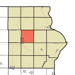
Makee Township covers an area of 35.69 square miles (92.4 km2) and contains one incorporated settlement, Waukon, which is the Allamakee County seat. According to the USGS, it contains five cemeteries: County Care Facility, Lycurgus, Makee Township, Oakland and Round Prairie.
References
- ↑ "US Board on Geographic Names". United States Geological Survey. 2007-10-25. Retrieved 2008-01-31.
- ↑ "American FactFinder". United States Census Bureau. Retrieved 2008-01-31.
- ↑ "IA - Makee township". United States Census Bureau. Retrieved March 17, 2013.
- ↑ Hancock, Ellery M. (1913). Past and Present of Allamakee County, Iowa: A Record of Settlement, Organization, Progress and Achievement, Volume 1. S. J. Clarke publishing Company. p. 227.
External links
Municipalities and communities of Allamakee County, Iowa, United States | ||
|---|---|---|
| Cities | ||
| Townships | ||
| Unincorporated communities | ||
| Footnotes | ‡This populated place also has portions in an adjacent county or counties | |
This article is issued from
Wikipedia.
The text is licensed under Creative Commons - Attribution - Sharealike.
Additional terms may apply for the media files.