Fairview Township, Allamakee County, Iowa
| Fairview Township, Allamakee County | |
|---|---|
| Township | |
 | |
| Coordinates: 43°07′25″N 091°14′09″W / 43.12361°N 91.23583°WCoordinates: 43°07′25″N 091°14′09″W / 43.12361°N 91.23583°W | |
| Country |
|
| State |
|
| County | Allamakee |
| Area | |
| • Total | 25.56 sq mi (66.21 km2) |
| • Land | 24.25 sq mi (62.81 km2) |
| • Water | 1.31 sq mi (3.4 km2) |
| Elevation[1] | 883 ft (269 m) |
| Population (2010) | |
| • Total | 240 |
| • Density | 9.9/sq mi (3.8/km2) |
| Time zone | UTC-6 (CST) |
| • Summer (DST) | UTC-5 (CDT) |
| FIPS code | 19-91290[2] |
| GNIS feature ID | 0467815 |
Fairview Township is one of eighteen townships in Allamakee County, Iowa, USA. At the 2010 census, its population was 240.[3]
History
Fairview Township was organized in 1855.[4]
Geography
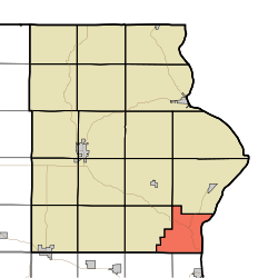
Fairview Township covers an area of 25.56 square miles (66.2 km2) and contains no incorporated settlements. According to the USGS, it contains three cemeteries: Grover Plot, Ion Methodist and Spaulding.
References
- ↑ "US Board on Geographic Names". United States Geological Survey. 2007-10-25. Retrieved 2008-01-31.
- ↑ "American FactFinder". United States Census Bureau. Archived from the original on 2013-09-11. Retrieved 2008-01-31.
- ↑ "IA - Farview township". United States Census Bureau. Retrieved March 17, 2013.
- ↑ Hancock, Ellery M. (1913). Past and Present of Allamakee County, Iowa: A Record of Settlement, Organization, Progress and Achievement, Volume 1. S. J. Clarke publishing Company. p. 227.
External links
Municipalities and communities of Allamakee County, Iowa, United States | ||
|---|---|---|
| Cities | ||
| Townships | ||
| Unincorporated communities | ||
| Footnotes | ‡This populated place also has portions in an adjacent county or counties | |
This article is issued from
Wikipedia.
The text is licensed under Creative Commons - Attribution - Sharealike.
Additional terms may apply for the media files.