Maiduguri International Airport
| Maiduguri International Airport | |||||||||||
|---|---|---|---|---|---|---|---|---|---|---|---|
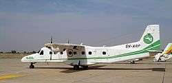 A Dornier Aviation Nigeria Dornier 228 at the airport in 2004 | |||||||||||
| Summary | |||||||||||
| Airport type | Public | ||||||||||
| Owner/Operator | Federal Airports Authority of Nigeria | ||||||||||
| Serves | Maiduguri, Borno Nigeria | ||||||||||
| Elevation AMSL | 1,099 ft / 335 m | ||||||||||
| Coordinates | 11°51′20″N 13°04′55″E / 11.85556°N 13.08194°E | ||||||||||
| Map | |||||||||||
 MIU Location of the airport in Nigeria | |||||||||||
| Runways | |||||||||||
| |||||||||||
Maiduguri International Airport (IATA: MIU, ICAO: DNMA) is an airport serving Maiduguri, the capital of Borno State in Nigeria.
The runway length does not include a 120 metres (390 ft) displaced threshold on each end.
The Maiduguri VOR-DME (Ident: MIU) is located 2.9 nautical miles (5.4 km) northeast of the airport.[4] The Maiduguri non-directional beacon (Ident: MA) is located on the field.[5]
Airlines and destinations
| Airlines | Destinations |
|---|---|
| Med-View Airline | Abuja |
| Azman Air | Abuja, Kano, Kaduna, Yola, Lagos |
See also


- Transport in Nigeria
- List of airports in Nigeria
References
- ↑ Airport information for DNMA at World Aero Data. Data current as of October 2006.Source: DAFIF.
- ↑ Airport information for MIU at Great Circle Mapper.
- ↑ Google Maps - Maiduguri
- ↑ "Maiduguri VOR-DME (MIU) @ OurAirports". ourairports.com. Retrieved 2018-08-21.
- ↑ "Maiduguri NDB (MA) @ OurAirports". ourairports.com. Retrieved 2018-08-21.
External links
- Accident history for MIU at Aviation Safety Network
- OpenStreetMap - Maiduguri
- SkyVector Aeronautical Charts
- OurAirports - Maiduguri
This article is issued from
Wikipedia.
The text is licensed under Creative Commons - Attribution - Sharealike.
Additional terms may apply for the media files.