Bhimdatta
| Bheemdatt भीमदत्त नगरपालिका Mahendranagar (महेन्द्रनगर) | |
|---|---|
| Municipality | |
 Bhimdatta municipality in Kanchanpur District | |
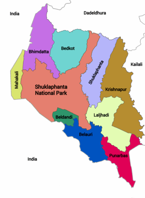
 Bheemdatt Location of Bheemdatt in Nepal | |
| Coordinates: 28°55′N 80°20′E / 28.917°N 80.333°ECoordinates: 28°55′N 80°20′E / 28.917°N 80.333°E | |
| Country | Nepal |
| State | Province No. 7 |
| Zone | Mahakali Zone |
| District | Kanchanpur District |
| Government | |
| • Mayor | Surendra Bist (NCP) |
| • Deputy Mayor | Sushila Chand Singh (NC) |
| Area[1] | |
| • Total | 171.24 km2 (66.12 sq mi) |
| Elevation[2] | 229 m (751 ft) |
| Population (2011) | |
| • Total | 104,444 |
| • Density | 610/km2 (1,600/sq mi) |
| Time zone | UTC+5:45 (NST) |
| Post code | 10400 |
| Area code(s) | 10406 |
| Literacy Rate | 77% (age 5+) |
| Website | http://bheemdattamun.gov.np |
Bheemdatt (Nepali: भीमदत्त), is a municipality in far western Nepal. Mahendranagar is a city and the headquarters of the district of Kanchanpur in Mahakali Zone. The city and the municipality was named Mahendranagar in the honour of late king Mahendra of Nepal. After becoming a republic in 2008, the Mahendranagar municipality name was changed to Bheemdatt municipality.
Mahendranagar is the 9th largest city in Nepal. It is 5 kilometres (3.1 mi) east of the Indian border and 700 kilometres (430 mi) west of Kathmandu. At the time of the 1991 Nepal census, it had a population of 62,050.[3] According to the census of 2001, the city's population was 80,839. Bheemdatt is a hub of activity for industries running between India and Nepal. It is also a gateway to Shuklaphanta National Park formerShuklaphanta Wildlife Reserve.
Society
The indigenous people living here are the Rana-Tharus but people from other parts mostly from the hill districts Baitadi, Darchula and Dadeldhura find themselves at home. Bheemdatt has become a unique combination of ethnic groups which has a different way of life within an already diverse country Nepal. The festivals celebrated by the ethnic Tharu people is Teej, Holi, Maghi festival while Hill People primarily celebrate Gora (commonly called Gaura Parba). Deepawali or Diwali or Tihar is a major festival which is celebrated with Laxmi Puja, Gai Puja, and Bhai Tika on their respective days. Dashain is also a major festival here.
Services
Bheemdatt is the business and educational hub of the Mahakali Zone. Since it is in close proximity to the border with India, Bheemdatta plays a major role in trade in the region. Students from neighbouring districts come for education. Far-western University teaches diversified disciplines ranging from Economics to Humanities to Sciences, is the only university in the city. People here are occupied by mainly agriculture as Nepal is an agrarian society. Business is another source of empowering the local economy which is concentrated in the bazaar area of Bheemdatt. Governmental Services is a significant part of the economy. Being comparatively closer to the major industrial areas of India, Mahendranagar could serve as a portal for industrial exchange between India and Nepal.
Transport and communication
Nepal Telecom provides 3G facilities in the area. Bheemdatt is connected to other parts of Nepal by East-West Highway which is the only road which connects it to the rest of Nepal. There is a domestic airport in Bheemdatt which is out of service. Bus service connects Bheemdatt to all the other parts of the country. There is a customs post for goods and third country nationals, while Indian and Nepalese nationals may cross the border freely. Banbasa, Uttarakhand state, India is in the other side of the border. Bheemdatt is the nearest place in Nepal to New Delhi, capital of India. Bheemdatt is also connected by sub-highways to hill towns Dipayal, Baitadi, Amargadhi, and Darchula.
Education
- Sunrise Public Higher Secondary School
- Florida International Boarding Higher Secondary School
- Rastriya Bal Vidhyalaya
- Radiant Secondary School
- Little Buddha Academy
- Kanchan Vidya Mindir
- International Public Higher Sec School
- Mahakali Modern Public School
International has been awarded Vidya Shield which is the most prestigious award for schools for 5 times.
Tourism
- Shuklaphanta National Park
- Jhilmila Lake
- Bedkot Lake
- Vishnu Temple
- Dodhara Chandani Suspension Bridge
- Bhimdutta Memorial Park
Media
To promote local culture Bheemdatt has many radio stations:
- Radio Mahakali 96.2 MHz
- Shuklaphanta FM 94.4MHz
- Radio Nagarik FM 104.3MHz
References
- ↑ http://www.muannepal.org.np/profiles_detail/bheemdatt-municipality.html
- ↑ http://elevationmap.net/bheemdatt-nepal?latlngs=(28.9872803,80.16518539999993)
- ↑ "Nepal Census 2001". Nepal's Village Development Committees. Digital Himalaya. Archived from the original on October 12, 2008. Retrieved November 24, 2008.
Headquarters: Bhimdatta | ||
| Municipalities |  | |
| Rural municipalities |
| |
| Former VDCs | ||
List of municipalities and rural municipalities of Nepal | ||