Magilligan
Magilligan
| |
|---|---|
 Magilligan Martello Tower | |
 Magilligan Magilligan shown within Northern Ireland | |
| Population | 578 (2001 Census) |
| Irish grid reference | H8396 |
| District | |
| County | |
| Country | Northern Ireland |
| Sovereign state | United Kingdom |
| Postcode district | BT |
| Dialling code | 028 |
| Police | Northern Ireland |
| Fire | Northern Ireland |
| Ambulance | Northern Ireland |
| EU Parliament | Northern Ireland |
| UK Parliament | |
| NI Assembly | |
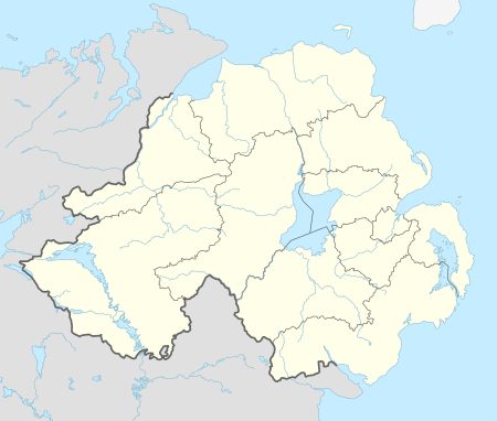
Magilligan (from Irish: Ard Mhic Giollagáin, meaning "Magilligan's height"[1]) is a peninsula that lies in the northwest of County Londonderry, Northern Ireland, at the entrance to Lough Foyle. It is a huge 79,000 acres (32,000 ha) coastal site, part British army firing range, part nature reserve. It gets its name from "MacGilligans country", which formed a major part of the barony of Keenaght. It is situated within Causeway Coast and Glens district.
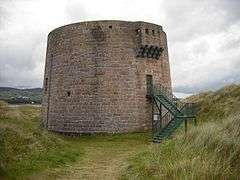
A Martello Tower was begun here in 1812, rather late in the British sequence, as the original plan for a fort at Magilligan point was impractical due to soft ground. A genuinely round tower mounting two 24 pounder guns, it has been beautifully restored but is normally locked. It was built at the same time as the more unusual double-gunned tower across the lough at Greencastle. It was not completed until 1817, two years after Napoleon, against whose invasion it was built to protect, had been exiled to St. Helena. The garrison stationed here never fired a shot at any enemy. During World War II the top of the tower was fitted out with a pillbox. Since the tower was built, deposits of sand have extended the peninsular by several hundred metres and the tower is now located a considerable distance from the sea.[2]
It is close to Bellarena railway station and there is a ferry service which operates all the year around with Greencastle across the lough.
The famous Irish harpist Donnchadh Ó Hámsaigh lived in Magilligan.
Ordnance Survey of Ireland
Magilligan served as the base line for triangulation for the mapping of Ireland in the 19th century. Colonel Thomas Colby chose Magilligan due to the flatness of the strand and its proximity to Scotland which, along with the rest of Britain, had been accurately mapped in previous decades. A straight line precisely 30,533 feet (9,306 m) was measured from North Station to Ballykelly in 1828 from which all other references were measured. The survey finished in 1846 when County Kerry was mapped.
References
- ↑ Placenames NI - Magilligan
- ↑ Northern Ireland Environment Agency information board at Martello Tower, August 2014.
External links
- Magilligan Sand Dunes virtual field trip
- Magilligan Martello Tower
- The Lough Foyle Ferry Company
- History of Magilligan 1600-1800
