Mae Taeng District
| Mae Taeng แม่แตง | |
|---|---|
| District | |
.jpg) Doi Kiew Lom | |
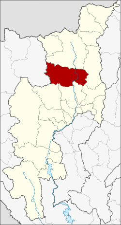 District location in Chiang Mai Province | |
| Coordinates: 19°7′19″N 98°56′37″E / 19.12194°N 98.94361°ECoordinates: 19°7′19″N 98°56′37″E / 19.12194°N 98.94361°E | |
| Country | Thailand |
| Province | Chiang Mai |
| Seat | San Maha Phon |
| Tambon | 13 |
| Muban | 120 |
| Area | |
| • Total | 1,362.784 km2 (526.174 sq mi) |
| Population (2014) | |
| • Total | 75,044 |
| • Density | 60.2/km2 (156/sq mi) |
| Time zone | UTC+7 (ICT) |
| Postal code | 50150, 50330 |
| Geocode | 5006 |
Mae Taeng (Thai: แม่แตง, pronounced [mɛ̂ː tɛ̄ːŋ]) is a district (amphoe) in the northern part of Chiang Mai Province in northern Thailand.
Geography
Neighboring districts are (from the north clockwise) Chiang Dao, Phrao, Doi Saket, San Sai, Mae Rim, Samoeng of Chiang Mai Province and Pai of Mae Hong Son Province.
The Taeng River, a river that has its source in the mountains of the Daen Lao Range in Wiang Haeng District, flows into the Ping River, one of the main tributaries of the Chao Phraya River, in Mae Taeng District.
History
In 1892, Khwaeng Mueang Kuet (เมืองกื้ด) was created, and renamed in 1894 to Khwaeng Mueang Kaen (เมืองแกน). In 1907 it was upgraded to a district (amphoe) named San Maha Phon (สันมหาพน), and renamed Mae Tang in 1939.[1]
Administration
Central administration
Mae Taeng is divided into 13 sub-districts (tambon), which are further subdivided into 120 administrative villages (Muban).
| No. | Name | Thai | Villages | Pop.[2] |
|---|---|---|---|---|
| 1. | San Maha Phon | สันมหาพน | 10 | 6,590 |
| 2. | Mae Taeng | แม่แตง | 8 | 4,398 |
| 3. | Khilek | ขี้เหล็ก | 11 | 9,334 |
| 4. | Cho Lae | ช่อแล | 6 | 4,467 |
| 5. | Mae Ho Phra | แม่หอพระ | 9 | 5,383 |
| 6. | Sop Poeng | สบเปิง | 13 | 7,753 |
| 7. | Ban Pao | บ้านเป้า | 7 | 3,657 |
| 8. | San Pa Yang | สันป่ายาง | 6 | 3,748 |
| 9. | Pa Pae | ป่าแป๋ | 13 | 6,175 |
| 10. | Mueang Kai | เมืองก๋าย | 5 | 1,637 |
| 11. | Ban Chang | บ้านช้าง | 5 | 3,883 |
| 12. | Kuet Chang | กื้ดช้าง | 8 | 5,152 |
| 13. | Inthakhin | อินทขิล | 19 | 12,867 |
Local administration
There is one town (thesaban mueang) in the district:
- Mueang Kaen Phatthana (Thai: เทศบาลเมืองเมืองแกนพัฒนา) consisting of sub-district Cho Lae and parts of sub-district Inthakhin.
There are five sub-district municipalities (thesaban tambons) in the district:
- San Maha Phon (Thai: เทศบาลตำบลสันมหาพน) consisting of sub-district San Maha Phon and parts of sub-district Khilek.
- Mae Taeng (Thai: เทศบาลตำบลแม่แตง) consisting of sub-district Mae Taeng.
- Chom Chaeng (Thai: เทศบาลตำบลจอมแจ้ง) consisting of parts of sub-district Khilek.
- Mae Ho Phra (Thai: เทศบาลตำบลแม่หอพระ) consisting of sub-district Mae Ho Phra.
- Inthakhin (Thai: เทศบาลตำบลอินทขิล) consisting of parts of sub-district Inthakhin.
There are seven subdistrict administrative organizations (SAO) in the district:
- Sop Poeng (Thai: องค์การบริหารส่วนตำบลสบเปิง) consisting of sub-district Sop Poeng.
- Ban Pao (Thai: องค์การบริหารส่วนตำบลบ้านเป้า) consisting of sub-district Ban Pao.
- San Pa Yang (Thai: องค์การบริหารส่วนตำบลสันป่ายาง) consisting of sub-district San Pa Yang.
- Pa Pae (Thai: องค์การบริหารส่วนตำบลป่าแป๋) consisting of sub-district Pa Pae.
- Mueang Kai (Thai: องค์การบริหารส่วนตำบลเมืองก๋าย) consisting of sub-district Mueang Kai.
- Ban Chang (Thai: องค์การบริหารส่วนตำบลบ้านช้าง) consisting of sub-district Ban Chang.
- Kuet Chang (Thai: องค์การบริหารส่วนตำบลกื้ดช้าง) consisting of sub-district Kuet Chang.
See also
| Wikimedia Commons has media related to Mae Taeng District. |
References
- ↑ พระราชกฤษฎีกาเปลี่ยนนามอำเภอ กิ่งอำเภอ และตำบลบางแห่ง พุทธศักราช ๒๔๘๒ (PDF). Royal Gazette (in Thai). 56 (ก): 354–364. April 17, 1939.
- ↑ "Population statistics 2014" (in Thai). Department of Provincial Administration. Retrieved 2015-03-30.
External links