Machapuchare
| Machhapuchare | |
|---|---|
| Machhapuchhre (Queen of the Mountains) | |
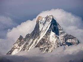 Machhapuchhare viewed from Tadapani. | |
| Highest point | |
| Elevation | 6,993 m (22,943 ft) |
| Prominence | 1,233 m (4,045 ft) |
| Coordinates | 28°29′42″N 83°56′57″E / 28.49500°N 83.94917°ECoordinates: 28°29′42″N 83°56′57″E / 28.49500°N 83.94917°E |
| Naming | |
| Native name | माछापुच्छ्रे |
| Translation | fish's tail |
| Geography | |
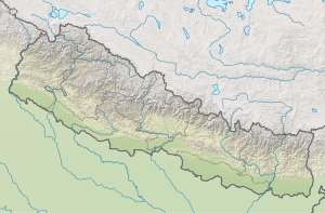 Machhapuchare Location in Nepal | |
| Location | North Central Nepal |
| Parent range | Annapurna Himalayas |
| Climbing | |
| First ascent | Unclimbed (ascents not allowed) |
Machapuchare, Machhapuchchhre or Machhapuchhre (from Nepali माछापुच्छ्रे , meaning 'fishtail'), is a mountain in the Annapurna Himalayas of north central Nepal. It is ranked thirteenth most beautiful mountain in the world by Telegraph, UK in April, 2018. It is revered by the local population as particularly sacred to the god Shiva, and hence is off limits to climbing.
Location
Machapuchare is at the end of a long spur ridge, coming south out of the main backbone of the Annapurna Himalayas, which forms the eastern boundary of the Annapurna Sanctuary. The Sanctuary is a favorite trekking destination, and the site of the base camps for the South Face of Annapurna and for numerous smaller objectives. The peak is about 25 km (16 mi) north of Pokhara, the main town of the region.
Notable features
Due to its southern position in the range, and the particularly low terrain that lies south of the Annapurna Himalayas, Machapuchare commands tremendous vertical relief in a short horizontal distance. This, combined with its steep, pointed profile, make it a particularly striking peak, despite a lower elevation than some of its neighbors. Its double summit resembles the tail of a fish, hence the name meaning "fish's tail" in Nepalese. It is also nicknamed the "Matterhorn of Nepal".
Climbing history
Machapuchare has never been climbed to its summit. The only attempt was in 1957 by a British team led by Lieutenant Colonel Jimmy Roberts. Climbers Wilfrid Noyce and A. D. M. Cox climbed to within 150 m (492 ft) of the summit via the north ridge, to an approximate altitude of 22,793 ft (6,947 m). They did not complete the ascent, as they had promised not to set foot on the actual summit.[1] Since then, the mountain has been declared sacred, and is now closed to climbers.
Gallery
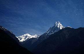 Falling star over Machapuchare
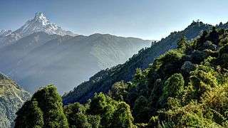 View from Kimrong
 On the way to Chomrong
_peak_from_Machhapuchchhre_base_camp_(MBC).jpg) Machhapuchchhre (Fish Tail) peak from Machhapuchchhre base camp (MBC)
Machhapuchchhre (Fish Tail) peak from Machhapuchchhre base camp (MBC)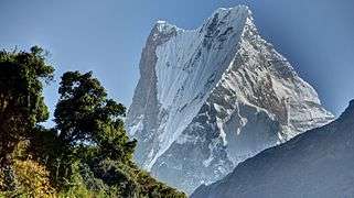 Above Chomrong
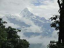
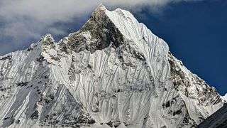 View from Annapurna Sanctuary
.JPG) Mt. Machapuchare
Mt. Machapuchare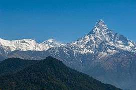 View of Mt. Machapuchare
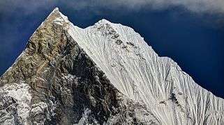 Upper summit part
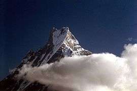 Machapuchare with its fishtail shaped silhouette that's given it its name clearly visible
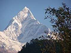 Machapuchare, view from foothills
 A view of the southern face of Machapuchare from Machapuchare Basecamp.
 A view of the south face of Machapuchare from Annapurna Base Camp at dawn.
Sources
- Andy Fanshawe and Stephen Venables, Himalaya Alpine Style. Hodder and Stoughton, 1995.
- Wilfrid Noyce, Climbing the Fish's Tail, London, 1958
- Koichiro Ohmori, Over The Himalaya, Cloudcap Press/The Mountaineers, 1994.
References
- ↑ Noyce, Wilfrid (1998) [1958]. Climbing the fish's tail. Delhi, India: Book Faith India / Pilgrims Book House. ISBN 8173031002. OCLC 857085947.
External links
| Wikimedia Commons has media related to Machhapuchchhre. |