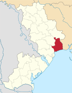
Lyman Raion, Odessa Oblast
| Lyman Raion Лиманський райо́н | |||
|---|---|---|---|
| Raion | |||
| |||
 | |||
| Coordinates: 46°49′12″N 30°56′42″E / 46.82000°N 30.94500°ECoordinates: 46°49′12″N 30°56′42″E / 46.82000°N 30.94500°E | |||
| Country |
| ||
| Region | Odessa Oblast | ||
| Established | 1923 | ||
| Admin. center | Dobroslav | ||
| Subdivisions |
List
| ||
| Area | |||
| • Total | 1,487 km2 (574 sq mi) | ||
| Population | |||
| • Total | 70,804 | ||
| • Density | 48/km2 (120/sq mi) | ||
| Time zone | UTC+2 (EET) | ||
| • Summer (DST) | UTC+3 (EEST) | ||
| Postal index | 67500—67587 | ||
| Area code | 380-04864 | ||

_COA.png)
Lyman Raion (Ukrainian: Лиманський район) is a raion (district) in Odessa Oblast of Ukraine. Its administrative center is the urban-type settlement of Dobroslav. Population: 71,157 (2017 est.)[1]
On 21 May 2016, Verkhovna Rada adopted decision to rename Kominternivske Raion to Lyman Raion and Kominternivske to Dobroslav according to the law prohibiting names of Communist origin.[1]
References
- 1 2 "Чисельність наявного населення України (Actual population of Ukraine)" (in Ukrainian). State Statistics Service of Ukraine. Retrieved 26 August 2017.
External links
![]()
| Raions | |||||
|---|---|---|---|---|---|
| Cities |
| ||||
| |||||
This article is issued from
Wikipedia.
The text is licensed under Creative Commons - Attribution - Sharealike.
Additional terms may apply for the media files.