Lwengo
| Lwengo | |
|---|---|
 Lwengo Location in Uganda | |
| Coordinates: 00°23′28″S 31°27′38″E / 0.39111°S 31.46056°E | |
| Country |
|
| Region | Central Uganda |
| District | Lwengo District |
| Elevation | 4,300 ft (1,300 m) |
| Population (2014 Census) | |
| • Total | 15,527[1] |
Lwengo is a town in Central Uganda. It is the chief municipal, administrative and commercial center of Lwengo District. It was known as Mbiriizi, prior to 1 July 2010.
Location
Lwengo is located approximately 35 kilometres (22 mi), by road, west of Masaka, the largest city in the sub-region.[2] This location lies approximately 165 kilometres (103 mi), by road, southwest of Kampala.[3]
Population
The 2014 national population census put the population of Lwengo Municipality at 15,527[1]
Points of interest
- The headquarters of Lwengo District Administration
- The offices of Lwengo Town Council
- Lwengo Central Market - The largest source of fresh produce in the town
- The headquarters of Lwengo Microfinance Cooperative Society Limited (LWEMICOS)
References
- 1 2 UBOS, . (27 August 2014). "The Population of The Regions of the Republic of Uganda And All Cities And Towns of More Than 15,000 Inhabitants". Citypopulation.de Quoting Uganda Bureau of Statistics (UBOS). Retrieved 26 February 2015.
- ↑ "Road Distance Between Masaka And Lwengo With Map". Globefeed.com. Retrieved 26 February 2015.
- ↑ "Map Showing Kampala And Lwengo With Route Marker". Globefeed.com. Retrieved 26 February 2015.
External links
Capital: Lwengo | ||
| Towns and villages | 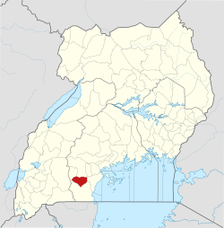 | |
| Economy |
| |
| Transport |
| |
| Health |
| |
This article is issued from
Wikipedia.
The text is licensed under Creative Commons - Attribution - Sharealike.
Additional terms may apply for the media files.