Luverne, Alabama
| Luverne, Alabama | |
|---|---|
| City | |
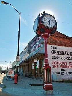 Downtown Luverne | |
| Nickname(s): "Friendliest City in the South"[1] | |
 Location of Luverne in Crenshaw County, Alabama. | |
| Coordinates: 31°42′52″N 86°15′48″W / 31.71444°N 86.26333°WCoordinates: 31°42′52″N 86°15′48″W / 31.71444°N 86.26333°W | |
| Country | United States |
| State | Alabama |
| County | Crenshaw |
| Founded | 1889 |
| Incorporated | February 6, 1891 |
| Founded by | M.P. Legrand, S.D. Hubbard, and George A. Folmar |
| Government | |
| • Type | Mayor/City Council |
| • Mayor | Ed Beasley |
| Area[2] | |
| • Total | 15.67 sq mi (40.60 km2) |
| • Land | 15.65 sq mi (40.53 km2) |
| • Water | 0.03 sq mi (0.07 km2) |
| Elevation | 354 ft (108 m) |
| Population (2010) | |
| • Total | 2,800 |
| • Estimate (2017)[3] | 2,770 |
| • Density | 177.03/sq mi (68.35/km2) |
| Time zone | UTC-6 (Central (CST)) |
| • Summer (DST) | UTC-5 (CDT) |
| ZIP code | 36049 |
| Area code(s) | 334 |
| FIPS code | 01-44728 |
| GNIS feature ID | 0122110 |
| Website |
www |
Luverne is a city in and the county seat of Crenshaw County, Alabama, United States. The city describes itself ais "The Friendliest City in the South", a slogan that appears on its "welcome" signs.[4] At the 2010 census the population was 2,800.[5]
History
Luverne was one of numerous towns developed in the state as a result of railroad construction. It was founded in 1889 in the central part of Crenshaw County, near the Patsaliga River, in association with the construction of the Montgomery and Florida Railroad; it was intended as the terminus. The new railroad station attracted related development and the town grew. It incorporated in 1891. This was a center of timbering in the Piney Woods of southern Alabama, as the land was not fertile enough to be suitable for large-scale cotton plantation agriculture.
In 1893, the citizens of Crenshaw County voted to move the county seat from Rutledge to the more populous Luverne.[6]
By the late 1930s, lynchings of African Americans were increasingly conducted in small groups or in secret, rather than in the former mass public displays.[7] On June 22, 1940, an African-American man named Jesse Thornton was lynched in Luverne for failing to address a white man with the title of "Mister". He was fatally shot and his body was later found in the Patsaliga River.[8] The Equal Justice Initiative documented that the white man Thornton had apparently offended by his Jim Crow infraction was a police officer.[9] This was the only lynching recorded in the county.
Geography
Luverne is located at 31°42′52″N 86°15′48″W / 31.714427°N 86.263323°W.[10] The town of Rutledge lies along Luverne's western border.
According to the U.S. Census Bureau, the city has a total area of 15.7 square miles (40.6 km2), of which 15.6 square miles (40.5 km2) is land and 0.04 square miles (0.1 km2), or 0.17%, is water.[5]
Demographics
| Historical population | |||
|---|---|---|---|
| Census | Pop. | %± | |
| 1890 | 451 | — | |
| 1900 | 731 | 62.1% | |
| 1910 | 1,384 | 89.3% | |
| 1920 | 1,464 | 5.8% | |
| 1930 | 1,874 | 28.0% | |
| 1940 | 2,243 | 19.7% | |
| 1950 | 2,221 | −1.0% | |
| 1960 | 2,238 | 0.8% | |
| 1970 | 2,440 | 9.0% | |
| 1980 | 2,639 | 8.2% | |
| 1990 | 2,555 | −3.2% | |
| 2000 | 2,635 | 3.1% | |
| 2010 | 2,800 | 6.3% | |
| Est. 2017 | 2,770 | [3] | −1.1% |
| U.S. Decennial Census[11] 2013 Estimate[12] | |||
As of the census[13] of 2000, there were 2,635 people, 1,107 households, and 710 families residing in the city.[14] The population density was 212.7 inhabitants per square mile (82.1/km2). There were 1,249 housing units at an average density of 100.8 per square mile (38.9/km2).[15][15] The racial makeup of the city was 70.25% White, 28.43% Black or African American, 0.08% Native American, 0.15% Asian, 0.04% Pacific Islander, 0.11% from other races, and 0.95% from two or more races. 0.68% of the population were Hispanic or Latino of any race.[14]
There were 1,107 households out of which 28.9% had children under the age of 18 living with them, 42.7% were married couples living together (2.4% same-sex couples), 19.5% had a female householder with no husband present, and 35.8% were non-families. 33.8% of all households were made up of individuals and 19.2% had someone living alone who was 65 years of age or older. The average household size was 2.24 and the average family size was 2.85.[14]
In the city, the population was spread out with 23.0% under the age of 18, 6.8% from 18 to 24, 23.4% from 25 to 44, 23.3% from 45 to 64, and 23.4% who were 65 years of age or older. The median age was 42 years. For every 100 females, there were 77.0 males. For every 100 females age 18 and over, there were 71.1 males.[14]
The median income for a household in the city was $22,457, and the median income for a family was $30,950. Males had a median income of $30,680 versus $17,813 for females. The per capita income for the city was $17,244. About 19.2% of families and 22.7% of the population were below the poverty line, including 31.3% of those under age 18 and 18.9% of those age 65 or over.[14]
2010 census
As of the census[16] of 2010, there were 2,800 people, 1,135 households, and 729 families residing in the city. The racial makeup of the city was 62.6% White, 29.6% Black or African American, 0.3% Native American, 5.5% Asian, 0.3% Pacific Islander, 0.8% from other races, and 1.0% from two or more races. 1.9% of the population were Hispanic or Latino of any race.
There were 1,135 households out of which 26.9% had children under the age of 18 living with them, 41.7% were married couples living together (2.4% same-sex couples), 19.2% had a female householder with no husband present, and 35.8% were non-families. 32.8% of all households were made up of individuals and 14.8% had someone living alone who was 65 years of age or older. The average household size was 2.35 and the average family size was 2.95.
In the city, the population was spread out with 23.8% under the age of 18, 7.9% from 18 to 24, 22.4% from 25 to 44, 26.3% from 45 to 64, and 19.7% who were 65 years of age or older. The median age was 41.2 years. For every 100 females, there were 84.6 males. For every 100 females age 18 and over, there were 85.3 males.
The median income for a household in the city was $40,602, and the median income for a family was $51,500. Males had a median income of $43,464 versus $19,483 for females. The per capita income for the city was $18,869. About 12.6% of families and 15.8% of the population were below the poverty line, including 11.8% of those under age 18 and 20.6% of those age 65 or over.
Education
- Primary and secondary education
Public education for the city of Luverne is provided by the Crenshaw County School District. There are two schools in the city: Luverne High School (grades K through 12) and Crenshaw Christian Academy, a private, religiously oriented K-12 school.
- Post-secondary education
Lurleen B. Wallace Community College offers certificate and two-year associate degrees at its Luverne location.
Media
Notable people
- Chester Adams, former American football guard
- Dorothy Bendross-Mindingall, former member of the Florida House of Representatives
- Wendell Mitchell, Served as a Democratic member of the Alabama Senate, representing the 30th District from 1974 to 2010
- Ryan Waters, Singer/Songwriter
Gallery
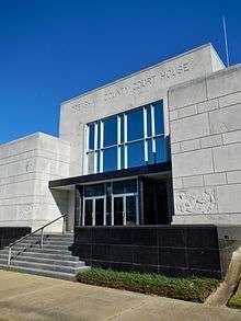 The Crenshaw County Courthouse in Luverne
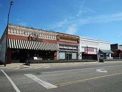 The Luverne Historic District, bounded by 1st, 6th Streets, Legrande, Glenwood, Folmar, and Hawkins Avenues, was added to the National Register of Historic Places on January 14, 2005.
.JPG) Luverne Post Office (ZIP code: 36049)
Luverne Post Office (ZIP code: 36049) Luverne Fire Department and Furman G. Mitchell Multi-Purpose Center
References
- ↑ Modleski, Tania (1986). Studies in Entertainment: Critical Approaches to Mass Culture. Indiana University Press. ISBN 0253355664.
- ↑ "2017 U.S. Gazetteer Files". United States Census Bureau. Retrieved Jul 7, 2018.
- 1 2 "Population and Housing Unit Estimates". Retrieved March 24, 2018.
- ↑ "Location: 42 | Rural Indexing Project". Rural Indexing Project. Retrieved 2018-09-02.
- 1 2 "Geographic Identifiers: 2010 Demographic Profile Data (G001): Luverne city, Alabama". U.S. Census Bureau, American Factfinder. Retrieved June 10, 2014.
- ↑ Sanford, William (December 10, 2009). "Luverne". Encyclopedia of Alabama. Retrieved January 28, 2010.
- ↑ Mrs. Jessie Daniels Ames, The Changing Character of Lynching, Commission on Interracial Cooperation, 1942
- ↑ [http://nationalhumanitiescenter.org/pds/maai3/segregation/text2/lynchingcrime.pdf Jessie P. Guzzman & W. Hardin Hughes, “Lynching-Crime,” Negro Year Book: A Review of Events Affecting Negro Life, 1944-1946, 1947; part of National Humanities Center, The Making of African American Identity, Vol. III, 1917-1968; accessed 04 June 2018
- ↑ Lynching in America: Confronting the Legacy of Racial Terror: Second Edition: Report Summary (PDF). Montgomery, Alabama: Equal Justice Initiative. 2015. p. 15.
In 1940, Jesse Thornton was lynched in Luverne, Alabama, for referring to a white police officer by his name without the title of "mister."
- ↑ "US Gazetteer files: 2010, 2000, and 1990". United States Census Bureau. 2011-02-12. Retrieved 2011-04-23.
- ↑ "U.S. Decennial Census". Census.gov. Retrieved June 6, 2013.
- ↑ "Annual Estimates of the Resident Population: April 1, 2010 to July 1, 2013". Retrieved June 3, 2014.
- ↑ "American FactFinder". United States Census Bureau. Retrieved 2008-01-31.
- 1 2 3 4 5 "Fact Sheet- Luverne city, Alabama". American Fast Facts. United States Census Bureau.
- 1 2 "Geographic Comparison Table- Alabama". American Fast Facts. United States Census Bureau.
- ↑ "American FactFinder". United States Census Bureau. Retrieved 2015-07-20.
External links
Municipalities and communities of Crenshaw County, Alabama, United States | ||
|---|---|---|
| Cities |  | |
| Towns | ||
| Unincorporated communities | ||
| Footnotes | ‡This populated place also has portions in an adjacent county or counties | |