Dozier, Alabama
| Dozier, Alabama | |
|---|---|
| Town | |
 Dozier in 2012 | |
 Location of Dozier in Crenshaw County, Alabama. | |
| Coordinates: 31°29′42″N 86°21′59″W / 31.49500°N 86.36639°WCoordinates: 31°29′42″N 86°21′59″W / 31.49500°N 86.36639°W | |
| Country | United States |
| State | Alabama |
| County | Crenshaw |
| Area[1] | |
| • Total | 2.96 sq mi (7.67 km2) |
| • Land | 2.95 sq mi (7.64 km2) |
| • Water | 0.01 sq mi (0.03 km2) |
| Elevation | 240 ft (73 m) |
| Population (2010) | |
| • Total | 329 |
| • Estimate (2017)[2] | 325 |
| • Density | 110.17/sq mi (42.53/km2) |
| Time zone | UTC-6 (Central (CST)) |
| • Summer (DST) | UTC-5 (CDT) |
| ZIP code | 36028 |
| Area code(s) | 334 |
| FIPS code | 01-21448 |
| GNIS feature ID | 0117451 |
Dozier /ˈdoʊʒər/ is a town in Crenshaw County, Alabama, United States. At the 2010 census the population was 329.[3] Dozier was incorporated in 1907.
Geography
Dozier is located in southern Crenshaw County at 31°29′43″N 86°22′0″W / 31.49528°N 86.36667°W (31.495233, −86.366592).[4] Its southern border is the Conecuh River, which is also the Covington County line.
According to the U.S. Census Bureau, the town has a total area of 3.0 square miles (7.7 km2), of which 0.012 square miles (0.03 km2), or 0.40%, is water.[3]
Demographics
| Historical population | |||
|---|---|---|---|
| Census | Pop. | %± | |
| 1910 | 288 | — | |
| 1920 | 237 | −17.7% | |
| 1930 | 377 | 59.1% | |
| 1940 | 399 | 5.8% | |
| 1950 | 362 | −9.3% | |
| 1960 | 335 | −7.5% | |
| 1970 | 304 | −9.3% | |
| 1980 | 494 | 62.5% | |
| 1990 | 483 | −2.2% | |
| 2000 | 391 | −19.0% | |
| 2010 | 329 | −15.9% | |
| Est. 2017 | 325 | [2] | −1.2% |
| U.S. Decennial Census[5] 2013 Estimate[6] | |||
As of the census[7] of 2000, there were 391 people, 167 households, and 106 families residing in the town. The population density was 132.2 people per square mile (51.0/km2). There were 196 housing units at an average density of 66.3 per square mile (25.6/km2). The racial makeup of the town was 57.03% White, 39.64% Black or African American, 2.05% from other races, and 1.28% from two or more races. 1.28% of the population were Hispanic or Latino of any race.
There were 167 households out of which 34.1% had children under the age of 18 living with them, 26.3% were married couples living together, 31.7% had a female householder with no husband present, and 36.5% were non-families. 33.5% of all households were made up of individuals and 16.2% had someone living alone who was 65 years of age or older. The average household size was 2.34 and the average family size was 2.92.
In the town, the population was spread out with 31.2% under the age of 18, 6.4% from 18 to 24, 27.4% from 25 to 44, 18.9% from 45 to 64, and 16.1% who were 65 years of age or older. The median age was 34 years. For every 100 females, there were 76.1 males. For every 100 females age 18 and over, there were 63.0 males.
The median income for a household in the town was $13,750, and the median income for a family was $16,667. Males had a median income of $23,438 versus $18,750 for females. The per capita income for the town was $8,964. About 42.6% of families and 49.9% of the population were below the poverty line, including 76.1% of those under age 18 and 39.7% of those age 65 or over.
Notable person
- Mal Moore, former American football player and athletic director for the University of Alabama
Gallery
 Dozier City Hall and Police Department
 Dozier Post Office (ZIP code: 36028)
 The old Dozier High School building
References
- ↑ "2017 U.S. Gazetteer Files". United States Census Bureau. Retrieved Jul 7, 2018.
- 1 2 "Population and Housing Unit Estimates". Retrieved March 24, 2018.
- 1 2 "Geographic Identifiers: 2010 Demographic Profile Data (G001): Dozier town, Alabama". U.S. Census Bureau, American Factfinder. Retrieved June 10, 2014.
- ↑ "US Gazetteer files: 2010, 2000, and 1990". United States Census Bureau. 2011-02-12. Retrieved 2011-04-23.
- ↑ "U.S. Decennial Census". Census.gov. Archived from the original on May 12, 2015. Retrieved June 6, 2013.
- ↑ "Annual Estimates of the Resident Population: April 1, 2010 to July 1, 2013". Retrieved June 3, 2014.
- ↑ "American FactFinder". United States Census Bureau. Archived from the original on September 11, 2013. Retrieved 2008-01-31.
External links
![]()
Municipalities and communities of Crenshaw County, Alabama, United States | ||
|---|---|---|
| Cities | 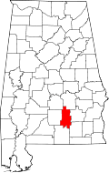 | |
| Towns | ||
| Unincorporated communities | ||
| Footnotes | ‡This populated place also has portions in an adjacent county or counties | |