Lutherville Historic District
|
Lutherville Historic District | |
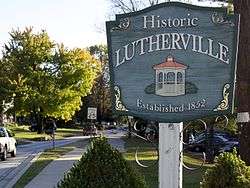 One of several signs surrounding the Lutherville, Maryland Historic District. Taken on Kurtz Ave. just past Ridgely Rd. | |
  | |
| Location | Roughly bounded by I 695, York and Ridgely Rds., and Lutherville Dr., Lutherville, Maryland |
|---|---|
| Coordinates | 39°25′19″N 76°38′41″W / 39.42194°N 76.64472°WCoordinates: 39°25′19″N 76°38′41″W / 39.42194°N 76.64472°W |
| Area | 276.5 acres (111.9 ha) |
| Built | 1852 |
| Architect | Morris, Dr. John Gottlieb |
| Architectural style | Colonial Revival, Late Victorian, Gothic Revival |
| NRHP reference # | 72000568[1] |
| Added to NRHP | November 9, 1972 |
Lutherville Historic District is a national historic district at Lutherville, Baltimore County, Maryland, United States. It is an irregularly shaped urban entity founded in 1852 as a summer resort and suburb of Baltimore City. Single-family dwellings on large lots characterize the community and most of the structures predate World War I, although ranch-type and "colonial" houses have appeared in the past few decades.[2]
It was added to the National Register of Historic Places in 1972.[1]
References
- 1 2 National Park Service (2010-07-09). "National Register Information System". National Register of Historic Places. National Park Service.
- ↑ Nancy Miller and Rodd L. Wheaton (July 1972). "National Register of Historic Places Registration: Lutherville Historic District" (PDF). Maryland Historical Trust. Retrieved 2016-03-01.
External links
- Lutherville Historic District, Baltimore County, including photo from 2000, at Maryland Historical Trust
- Boundary Map of the Lutherville Historic District, Baltimore County, at Maryland Historical Trust

| Topics |  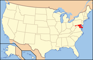 | |
|---|---|---|
| Lists by county | ||
| Lists by city | ||
| Other lists | ||
| ||
This article is issued from
Wikipedia.
The text is licensed under Creative Commons - Attribution - Sharealike.
Additional terms may apply for the media files.