Lulonga River
Coordinates: 0°38′40″N 18°22′58″E / 0.644489°N 18.3827877°E
| Lulonga River | |
|---|---|
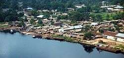 The Lulonga River at the port of Basankusu | |
| Country | Democratic Republic of the Congo |
| Physical characteristics | |
| River mouth | Congo River |
| Length | 200 km (120 mi) |
| Basin features | |
| Tributaries | |
The Lulonga is a river in the Equateur province of Democratic Republic of the Congo. It is about 200 km long from its beginning at the town of Basankusu. There the Lopori and the Maringa join to form the Lulonga. The Lulonga river flows into the Congo River at the town Lulonga.[1]
References
- ↑ Jef Dupain; Janet Nackoney; Jean-Paul Kibambe; Didier Bokelo & David Williams. "Maringa-Lopori-Wamba Landscape" (PDF). L'Observatoire des Forêts d'Afrique Centrale. Retrieved 2011-10-14.
| Congo left bank (south) | 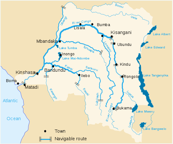 | |
|---|---|---|
| Kasai and tributaries | ||
| Congo right bank (north) | ||
| Lualaba and tributaries | ||
| Other | ||
This article is issued from
Wikipedia.
The text is licensed under Creative Commons - Attribution - Sharealike.
Additional terms may apply for the media files.