Lufira River
Coordinates: 11°01′15″S 26°57′14″E / 11.020817°S 26.953754°E
 The Lualaba River, in red | |
| Country | Democratic Republic of the Congo |
|---|---|
| Physical characteristics | |
| River mouth | Lualaba River |
| Length | 500 km (310 mi) |
| Official name | Bassin de la Lufira |
| Designated | 31 October 2017 |
| Reference no. | 2318[1] |
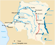
The Lufira River is a tributary of the Lualaba River in the Democratic Republic of the Congo (DRC).
The Lufira rises in the Shaba plateau south of Likasi. The river was dammed in 1926 at Mwadingusha near Likasi to form Lake Tshangalele, a reservoir for a hydroelectric generator supplying power for copper smelting. It flows northwards through the Bia Mountains for about 500 kilometres (310 mi), joining the Lualaba in Lake Kisale.
References
- ↑ "Bassin de la Lufira". Ramsar Sites Information Service. Retrieved 25 April 2018.
| Congo left bank (south) | 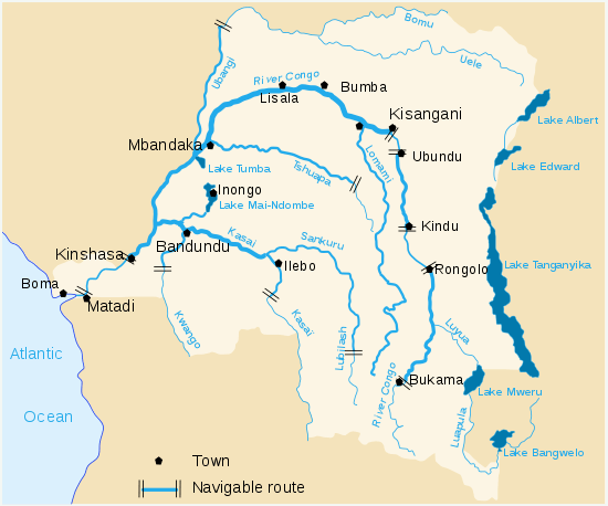 | |
|---|---|---|
| Kasai and tributaries | ||
| Congo right bank (north) | ||
| Lualaba and tributaries | ||
| Other | ||
This article is issued from
Wikipedia.
The text is licensed under Creative Commons - Attribution - Sharealike.
Additional terms may apply for the media files.