Lowndes, Missouri
| Lowndes | |
|---|---|
| Unincorporated community | |
 Lowndes Location within the state of Missouri | |
| Coordinates: 37°08′56″N 90°15′48″W / 37.14889°N 90.26333°WCoordinates: 37°08′56″N 90°15′48″W / 37.14889°N 90.26333°W[1] | |
| Country | United States |
| State | Missouri |
| County | Wayne |
| Elevation[1] | 443 ft (135 m) |
| Time zone | UTC-6 (Central (CST)) |
| • Summer (DST) | UTC-5 (CDT) |
| ZIP codes | 63951 |
| GNIS feature ID | 750889[1] |
Lowndes is an unincorporated community in eastern Wayne County, Missouri, United States. It is located about twenty miles southwest of Marble Hill along Missouri Route E. Bear Creek flows past the north side of the community and Barnes Creek is just east of the community.[2]
A post office called Lowndes has been in operation since 1840.[3] The community has the name of Lowndes Henry Davis, a state legislator.[4]
Notable resident
- Leo Goodwin, Sr., founder of GEICO, was born here in 1886.[5]
References
- 1 2 3 U.S. Geological Survey Geographic Names Information System: Lowndes, Missouri
- ↑ Missouri Atlas & Gazetteer, DeLorme, 1998, First edition, p. 57, ISBN 0-89933-224-2
- ↑ "Post Offices". Jim Forte Postal History. Retrieved 1 January 2017.
- ↑ "Wayne County Place Names, 1928–1945". The State Historical Society of Missouri. Archived from the original on June 24, 2016. Retrieved January 1, 2017.
- ↑ "About Us". Nova Southeastern University. Retrieved 1 January 2017.
Municipalities and communities of Wayne County, Missouri, United States | ||
|---|---|---|
| Cities | 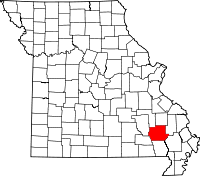 | |
| Village | ||
| Townships | ||
| Unincorporated communities | ||
| Ghost towns | ||
This article is issued from
Wikipedia.
The text is licensed under Creative Commons - Attribution - Sharealike.
Additional terms may apply for the media files.