Lower Porthpean
| Lower Porthpean | |
|---|---|
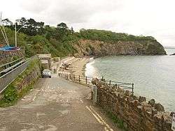 Porthpean Beach | |
 Lower Porthpean Lower Porthpean shown within Cornwall | |
| OS grid reference | SX031507 |
| Unitary authority | |
| Ceremonial county | |
| Region | |
| Country | England |
| Sovereign state | United Kingdom |
| EU Parliament | South West England |
Lower Porthpean is a coastal hamlet in Cornwall, England, UK.[1] It is close to Higher Porthpean and one mile south of St Austell.[2]
References
Cornwall Portal | |
| Unitary authorities | |
| Major settlements |
|
| Rivers | |
| Topics | |
This article is issued from
Wikipedia.
The text is licensed under Creative Commons - Attribution - Sharealike.
Additional terms may apply for the media files.