Lossa (Mulde)
| Lossa | |
|---|---|
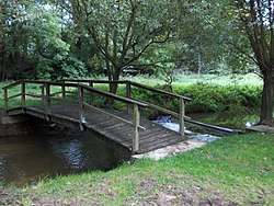 Bridge over the Lossa at Lossaer Schloß (Thallwitz) | |
| Location | Germany, Saxony |
| Reference no. | DE: 5492 |
| Physical characteristics | |
| Main source |
near Falkenhain (confluence of its headstreams) 51°22′43″N 12°54′19″E / 51.3786917°N 12.9053083°ECoordinates: 51°22′43″N 12°54′19″E / 51.3786917°N 12.9053083°E |
| River mouth |
south of Eilenburg into the Mulde 51°27′12″N 12°39′06″E / 51.4533444°N 12.6515389°E |
| Length | 21 km |
| Basin features | |
| Progression | Mulde→ Elbe→ North Sea |
| River system | Elbe |
| Basin size | 153 km² |
| Landmarks | Small towns: Wurzen, Belgern-Schildau, Eilenburg |
The Lossa is a small river in Saxony and a tributary of the Mulde.
Course
The Lossa rises east of the Wurzen village of Kühren. The Lossabach, a tributary of the Lossa, has its origin east of the village of Ochsensaal (which belongs to Dahlen). In the vicinity of the Lossatal village of Müglenz the Lossabach empties into the Lossa. The Lossa then continues northwest through Hohburg, past the southern side of the Hohburg Hills, through the eponymous village of Lossa and through Thallwitz. Just south of Eilenburg the stream discharges into the Mulde. Originally it joined the main river several hundred metres further north, but due to the construction of the German Celluloid Factory in Eilenburg, it was diverted into the Mulde just before entering the town borough in the second half of the 19th century.
In Thallwitz the stream is impounded by a small weir to form a pond, the Herrenteich.[1]
References
- ↑ www.wasser.muldental-tourismus.de Archived 2009-09-11 at the Wayback Machine.