Lockengate
| Lockengate | |
|---|---|
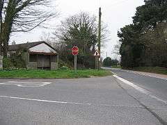 The bus shelter at Lockengate | |
 Lockengate Lockengate shown within Cornwall | |
| OS grid reference | SX031613 |
| Civil parish |
|
| Unitary authority | |
| Ceremonial county | |
| Region | |
| Country | England |
| Sovereign state | United Kingdom |
| Post town | St Austell |
| Postcode district | PL26 |
| EU Parliament | South West England |
Lockengate is a hamlet in Cornwall, England, UK.[1] It is two miles south of Lanivet on the A391 road.[2] It is in the civil parish of Luxulyan
There was once a mission church here which was sold in 1972.[3] This church already existed in 1877.[4]
References
- ↑ Ordnance Survey: Landranger map sheet 200 Newquay & Bodmin (Camelford & St Austell) (Map). Ordnance Survey. ISBN 978-0-319-22938-5.
- ↑ Ordnance Survey One-inch Map of Great Britain; Bodmin and Launceston, sheet 186. 1961.
- ↑ Langdon, A. G. (2002) Stone Crosses in Mid Cornwall; 2nd ed. Federation of Old Cornwall Societies; p. 53
- ↑ Jago, W. (1877) An Ecclesiastical Map of the Diocese of Truro
Cornwall Portal | |
| Unitary authorities | |
| Major settlements |
|
| Rivers | |
| Topics | |
This article is issued from
Wikipedia.
The text is licensed under Creative Commons - Attribution - Sharealike.
Additional terms may apply for the media files.