Loch Kennard
| Loch Kennard | |
|---|---|
 Loch Kennard | |
| Location | NN907460 |
| Coordinates | 56°35′36″N 3°46′53″W / 56.5933°N 3.7815°WCoordinates: 56°35′36″N 3°46′53″W / 56.5933°N 3.7815°W |
| Type | freshwater loch |
| Primary outflows | Ballinloan Burn |
| Max. length | 1.0621 km (0.6600 mi)[1] |
| Max. width | 0.53 km (0.33 mi)[1] |
| Surface area | 30.1 ha (74 acres)[2] |
| Average depth | 32.25 ft (9.83 m)[1] |
| Max. depth | 72 ft (22 m)[1] |
| Water volume | 108,439,000 cu ft (3,070,700 m3)[1] |
| Shore length1 | 2.9 km (1.8 mi) [2] |
| Surface elevation | 407 m (1,335 ft)[2] |
| Max. temperature | 56.7 °F (13.7 °C) |
| Min. temperature | 45.3 °F (7.4 °C) |
| 1 Shore length is not a well-defined measure. | |
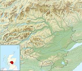
Loch Kennard is freshwater loch located south-east of Aberfeldy, situated on Grandtully Hill in Perth and Kinross within Griffin Forest in Scotland.[3][1][2]
References
- 1 2 3 4 5 6 John, Murray; Lawrence, Pullar (1910). Bathymetrical Survey of the Fresh-Water Lochs of Scotland, 1897-1909 Lochs of the Tay Basin Volume II - Loch Kennard. National Library of Scotland: National Challenger Officer. p. 87. Retrieved 14 September 2018.

- 1 2 3 4 "Loch Kennard". British Lakes. Retrieved 14 September 2018.
- ↑ Gittings, Bruce; Munro, David. "Kennard, Loch". The Gazetteer for Scotland. School of GeoSciences, University of Edinburgh and The Royal Scottish Geographical Society. Retrieved 14 September 2018.
This article is issued from
Wikipedia.
The text is licensed under Creative Commons - Attribution - Sharealike.
Additional terms may apply for the media files.