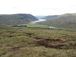
Loch Garry, Dalnaspidal
| Loch Garry | |
|---|---|
 View of | |
 Loch Garry | |
| Location | grid reference NN630702 |
| Coordinates | 56°48′14″N 4°14′42″W / 56.803800°N 4.2451°WCoordinates: 56°48′14″N 4°14′42″W / 56.803800°N 4.2451°W |
| Type | freshwater loch |
| Primary outflows | River Garry |
| Max. length | 4.02336 km (2.50000 mi)[1] |
| Max. width | 0.4 km (0.25 mi)[1] |
| Surface area | 164 ha (410 acres)[2] |
| Average depth | 113 ft (34 m)[1] |
| Max. depth | 50 ft (15 m)[1] |
| Shore length1 | 11.2 km (7.0 mi) [2] |
| Surface elevation | 412 m (1,352 ft)[2] |
| 1 Shore length is not a well-defined measure. | |
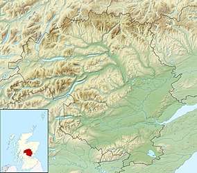
Loch Garry is a large upland freshwater loch located in Perth and Kinross in Scotland. [1][2]
References
- 1 2 3 4 5 John, Murray; Lawrence, Pullar (1910). Bathymetrical Survey of the Fresh-Water Lochs of Scotland, 1897-1909 Lochs of the Tay Basin Volume II - Loch Garry. National Library of Scotland: National Challenger Officer. p. 57. Retrieved 3 June 2018.

- 1 2 3 4 "Loch Garry". British Lakes. Retrieved 3 June 2018.
This article is issued from
Wikipedia.
The text is licensed under Creative Commons - Attribution - Sharealike.
Additional terms may apply for the media files.