Loch Derculich
| Loch Derculich | |
|---|---|
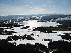 Frozen Loch Derculich | |
 Loch Derculich | |
| Coordinates | 56°40′22″N 3°51′16″W / 56.6727°N 3.8545°WCoordinates: 56°40′22″N 3°51′16″W / 56.6727°N 3.8545°W |
| Type | freshwater loch |
| River sources | Derculich Burn |
| Max. length | 0.804 km (0.500 mi)[1] |
| Max. width | 0.402 km (0.250 mi)[1] |
| Surface area | 39.9 ha (99 acres)[2] |
| Average depth | 25 ft (7.6 m)[1] |
| Max. depth | 70 ft (21 m)[1] |
| Water volume | 108,333,000 cu ft (3,067,600 m3)[1] |
| Shore length1 | 3.3 km (2.1 mi) [2] |
| Surface elevation | 367 m (1,204 ft)[2] |
| Max. temperature | 55 °F (13 °C) |
| Min. temperature | 47 °F (8 °C) |
| Settlements | Aberfeldy |
| 1 Shore length is not a well-defined measure. | |
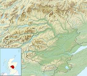
Loch Derculich is a freshwater loch in central highlands of Scotland, in Perth and Kinross.[1][2] Loch Tummel is located three miles to the north.[3]
Habitation
Evidence of Shieling huts in two groups are visible from oblique aerial photography, that consist of two groups in either side of a gully on the South of Loch Derculich. A trackway runs to the SW of the huts. What may be a hut-circle lies beside a more modern track to the north-east of the huts.[4]
References
- 1 2 3 4 5 6 John, Murray; Lawrence, Pullar (1910). Bathymetrical Survey of the Fresh-Water Lochs of Scotland, 1897-1909 Lochs of the Tay Basin Volume II - Loch of Butterstone. National Library of Scotland: National Challenger Officer. p. 83. Retrieved 24 July 2018.

- 1 2 3 4 "Loch Derculich". British Lakes. Retrieved 24 July 2018.
- ↑ "Derculich, Loch". The Gazetteer for Scotland. School of GeoSciences, University of Edinburgh and The Royal Scottish Geographical Society. Retrieved 24 July 2018.
- ↑ "Loch Derculich Hut Circle". Canmore National Record of the Historic Environment. Historic Environment Scotland. Retrieved 24 July 2018.
This article is issued from
Wikipedia.
The text is licensed under Creative Commons - Attribution - Sharealike.
Additional terms may apply for the media files.