Livera
| Livera | |
|---|---|
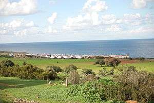 View of Livera | |
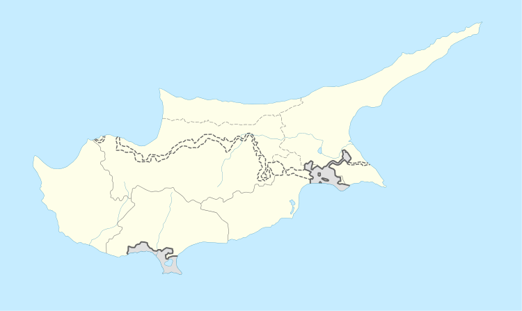 Livera Location in Cyprus | |
| Coordinates: 35°22′58″N 32°57′11″E / 35.38278°N 32.95306°ECoordinates: 35°22′58″N 32°57′11″E / 35.38278°N 32.95306°E | |
| Country |
|
| • District | Kyrenia District |
| Country (controlled by) |
|
| • District | Girne District |
| Population (2011)[1] | |
| • Total | 170 |
| Time zone | UTC+2 (EET) |
| • Summer (DST) | UTC+3 (EEST) |
Livera (Greek: Λιβερά; Turkish: Sadrazamköy) is a small village on Cape Kormakitis, Cyprus, 8 km northwest of Kormakitis. De facto, it is under the control of Northern Cyprus.
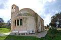 St. Constantine's church in Livera
References
- ↑ KKTC 2011 Nüfus ve Konut Sayımı [TRNC 2011 Population and Housing Census] (PDF), TRNC State Planning Organization, 6 August 2013, archived from the original (PDF) on 6 November 2013
This article is issued from
Wikipedia.
The text is licensed under Creative Commons - Attribution - Sharealike.
Additional terms may apply for the media files.