Agridaki
| Agridaki | |
|---|---|
 | |
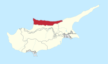
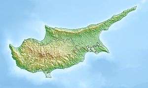 Agridaki Location in Cyprus | |
| Coordinates: 35°18′25″N 33°9′7″E / 35.30694°N 33.15194°ECoordinates: 35°18′25″N 33°9′7″E / 35.30694°N 33.15194°E | |
| Country |
|
| • District | Kyrenia District |
| Country (controlled by) |
|
| • District | Girne District |
| Population (2011)[1] | |
| • Total | 86 |
| Time zone | UTC+2 (EET) |
| • Summer (DST) | UTC+3 (EEST) |
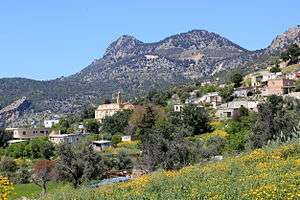
Agridaki (Greek: Αγριδάκι; Turkish: Alemdağ) is a village in Cyprus, located 1 km east of Larnakas tis Lapithou. Agridaki is under the de facto control of Northern Cyprus. Before the 1974 Turkish invasion of Cyprus, the village was inhabited by Greek Cypriots. They fled before the Turkish forces reached the village. Agridaki is now inhabited by Turkish Cypriots from Paphos District.
Agios Charalampos
The village has a church dating back to 1908. Most of the church interior is now in ruins. In a corner, there is a small iconostasis dedicated to the saint of the church.
 Church in Agridaki
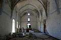 Church interior
 Church interior
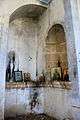 Iconostasis in the corner
 View from clock tower
References
- ↑ "KKTC 2011 Nüfus ve Konut Sayımı" [TRNC 2011 Population and Housing Census] (PDF) (in Turkish). TRNC State Planning Organization. 6 August 2013. p. 21. Archived from the original (PDF) on 6 November 2013.
External links
| Wikimedia Commons has media related to Agridaki. |
This article is issued from
Wikipedia.
The text is licensed under Creative Commons - Attribution - Sharealike.
Additional terms may apply for the media files.