Little Withlacoochee River
Coordinates: 28°34′23″N 82°11′59″W / 28.57306°N 82.19972°W
The Little Withlacoochee River is a 16 mile (26 kilometer) long river[1][2] with its headwaters starting in the Richloam Wildlife Management Area in Sumter County, Florida. The Little Withlacoochee River ends near River Junction Campground just east of Silver Lake in the Croom Wildlife Management Area. It makes up a portion of the Hernando-Sumter County border. Its drainage basin covers 145mi² (376km²)[3] of Hernando County and Sumter County.
Course
The course of the Little Withlacoochee River flows through mostly wilderness, mainly Richloam Wilderness Management Area (WMA), one of seven tracts of the Withlacoochee State Forest. Richloam covers 58,000 acres of pine flatwoods and cypress swamps; over 4 counties: Hernando, Sumter, Pasco, and Lake. Richloam features fishing, hunting, and hiking trails.[4] The exception is a small, undeveloped neighborhood near Ridge Manor. The river empties into the Withlacoochee River in Croom WMA, another tract of the Withlacoochee State Forest. Croom also covers 20,000 acres of pine flatwoods over Hernando County and Sumter County. Croom includes Silver Lake. It features a combined 138 miles of biking, hiking, and horse trails.[5]
River crossings
| Crossing | Carries | Location | Image | Coordinates |
|---|---|---|---|---|
| Headwaters (Richloam WMA) | 28°29′41″N 82°00′35″W / 28.49472°N 82.00972°W | |||
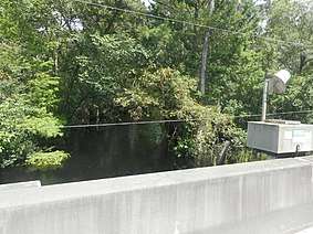
| 180012 | Hernando-Sumter Line |  |
28°31′17″N 82°03′16″W / 28.52139°N 82.05444°W | |
| 180071 | Hernando-Sumter Line |  |
28°31′29″N 82°05′48″W / 28.52472°N 82.09667°W | |
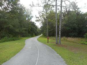
| 080035 | Ridge Manor |  |
28°34′22″N 82°09′19″W / 28.57278°N 82.15528°W | |
| Mouth (Confluence with Withlacoochee River) | 28°29′39″N 82°00′35″W / 28.49417°N 82.00972°W | |||
References
- ↑ "Streamer Print Map". txpub.usgs.gov. Retrieved 2018-10-14.
- ↑ "USGS - Streamer". United States Geological Survey, Texas Water Science Center. Retrieved 2018-10-14.
- ↑ "USGS Site Map for USGS 02312200 LITTLE WITHLACOOCHEE RIVER AT RERDELL, FL". waterdata.usgs.gov. Retrieved 2018-10-14.
- ↑ "Richloam Wildlife Management Area". myfwc.com. Retrieved 2018-10-14.
- ↑ "Croom Wildlife Management Area". myfwc.com. Retrieved 2018-10-14.