Little Nashville, Alabama
| Little Nashville, Alabama | |
|---|---|
| Ghost town | |
 Little Nashville  Little Nashville | |
| Coordinates: 34°45′10″N 86°13′52″W / 34.75278°N 86.23111°WCoordinates: 34°45′10″N 86°13′52″W / 34.75278°N 86.23111°W | |
| Country | United States |
| State | Alabama |
| County | Jackson |
| Elevation | 630 ft (190 m) |
| Time zone | UTC-6 (Central (CST)) |
| • Summer (DST) | UTC-5 (CDT) |
| GNIS feature ID | 156615[1] |
Little Nashville is a ghost town in Jackson County, Alabama, United States.[1][2]
The settlement was located along the Paint Rock River. Northeast of the settlement is a hilly projection of land called "Little Nashville Point".[3]
History
The settlement was named "Little Nashville" because a steel bridge fabricated in Nashville, Tennessee crossed the Paint Rock River at that location. Little Nashville was once "a thriving village".[2]
A former home in Little Nashville was described as the Paint Rock River valley's best example of Queen Anne style architecture, while The Browning House (c. 1850) west of Little Nashville served as a Union Army hospital during the Civil War.[4]
Little Nashville Farm, a 972 acres (393 ha) property identified as an "Alabama Treasure Forest", is located at the former settlement.[2]
References
- 1 2 "Little Nashville". Geographic Names Information System. United States Geological Survey.
- 1 2 3 Vansant, Coleen (Winter 1999). "Forest Management "Mountain Style"" (PDF). Alabama's Treasured Forests. Alabama Forestry Commission.
- ↑ "Little Nashville Point". Geographic Names Information System. United States Geological Survey.
- ↑ "Historic Resources of the Paint Rock Valley, 1820-1954". National Park Service. March 1992.
Municipalities and communities of Jackson County, Alabama, United States | ||
|---|---|---|
| Cities | 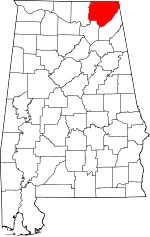 | |
| Towns | ||
| Unincorporated communities | ||
| Ghost towns | ||