List of streets and roads in Manchester
The following is a list of notable streets and roads in Manchester, England.
| Image | Street name | A/B roads | Established | Description/notes | Landmarks |
|---|---|---|---|---|---|
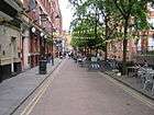 | Canal Street | Early 19th century | Home to Manchester's vibrant Gay Village district | Rochdale Canal which runs parallel. | |
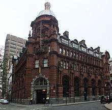
 | Cheetham Hill Road | A665 | Roman Period | Connects to Corporation Street to Whitefield becomes Bury Old Road in Crumpsall | Manchester Jewish Museum, Peninsula Building |
 | Corporation Street | Ca. 1848[1] | Partly pedestrianised. Scene of the 1996 Manchester bombing. | Recognisable landmarks include Urbis, The Printworks, Corn Exchange (now The Triangle), Exchange Square, Corporation Street Bridge. | |
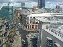
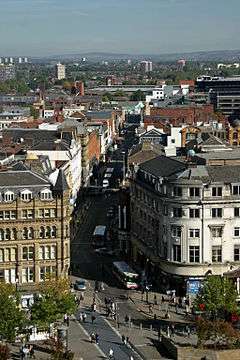
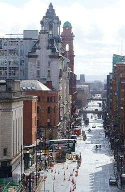
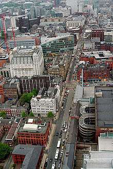 | Deansgate | A56 | Anglo-Saxon period[2] | Cuts the city centre in two and runs roughly north–south in a near straight route through the western part of the city centre. It is one of the oldest thoroughfares through the city and is the longest road in the city centre at over one mile long.[3] | The Moon Under Water, listed in Guinness' as largest public house in Britain.[4] Beetham Tower, John Rylands Library, 1 The Avenue, Great Northern Warehouse, Kendals and Manchester Cathedral. |
 | King Street | 18th century[5] | King Street forms an upmarket part of the city centre: its eastern part was once mainly the site of banks but now has shops as well; the western part is a long-established shopping street | conservation area for Listed Buildings (11 buildings listed Grade II, two listed Grade II* and one Grade I). Notable buildings include 100 King Street by Sir Edwin Lutyens, Ship Canal House and the Reform Club by Edward Salomons. | |
 | Kingsway | A34 | 1928 | Major thoroughfare into Manchester from southern suburbs such as Cheadle and Burnage | Parrs Wood Entertainment Centre |
 | Market Street | Before 1417[6] | pedestrian zone end to end; Metrolink stop at High Street; Royal Exchange | ||
 | Mosley Street | Late 18th century[7] | A street only for Metrolink trams and previously buses which joined the street at Lower Mosley Street. Since May 2011, buses were segregated and travel down Portland Street instead of Mosley Street to get to Piccadilly Gardens bus station | Recognisable buildings include the Midland Hotel, One St Peter's Square, Manchester Art Gallery, Portico Library, 38 and 42 Mosley Street, 1 New York Street, Mosley Street Metrolink station | |
 | New Cathedral Street | 1990s | Rebuilt since the 1996 IRA bombing of the city centre | ||
 | Oldham Street | Early 18th century | Forms part of the city's historic Northern Quarter district | Afflecks Palace[8] | |
 | Oxford Road | A34 | Late 18th century[9] | ||
 | Portland Street | Early 19th century | Watts Warehouse | ||
 | Princess Street | Late 18th century | A 3-lane partially one-way street heading out of Manchester city centre | The Athenaeum & Asia House | |
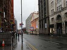 | Quay Street | Early 18th century[10] | Home of ITV Granada Television since 1956 at Granada Studios. Recognised landmarks include the Manchester Opera House and Art Deco Sunlight House | ||
 | Sackville Street | Sackville Street Building, University of Manchester including the Godlee Observatory | |||
 | Spring Gardens | Former centre of North West Banking Industry | Former National Westminster Bank | ||
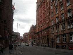 | Whitworth Street | 1899 | The Haçienda[11] Sackville Street Building, University of Manchester including the Godlee Observatory | ||
| Wilmslow Road | 18th century | Forms the Wilmslow Road bus corridor, reputed to be the busiest in Europe[12] | |||
References
- ↑ Bradshaw, L. D. (1985). Origins of Street Names in the City of Manchester. Radcliffe: Neil Richardson. ISBN 0-907511-87-2; pp. 18-20
- ↑ Bradshaw, L. D. (1985). Origins of Street Names in the City of Manchester. Radcliffe: Neil Richardson. ISBN 0-907511-87-2; p. 20
- ↑ "Manchester Deansgate Bars". manchesterbars.com. Retrieved 4 August 2011.
Located at the top end of Deansgate, the mile long road that runs through the city centre
- ↑ Parkinson-Bailey, John J. (2000). Manchester: an architectural history. Manchester University Press. p. 287. ISBN 0-7190-5606-3.
- ↑ "Upper King Street Conservation Area History". Manchester City Council. Retrieved 2010-08-23.
Early 18th century development of the area took the form of fashionable residences to rival the Hanoverian houses in St. Ann's Square. Originally known as St. James's Square, the name was changed to King Street after the Jacobite defeat of 1745.
- ↑ Bradshaw, L. D. (1985). Origins of Street Names in the City of Manchester. Radcliffe: Neil Richardson. ISBN 0-907511-87-2; pp. 30-31
- ↑ Bradshaw, L. D. (1985). Origins of Street Names in the City of Manchester. Radcliffe: Neil Richardson. ISBN 0-907511-87-2; pp. 32-34
- ↑ Taylor, Ian R.; Evans, Karen; Fraser, Penny (1996). A Tale of Two Cities. Routledge. p. 125. ISBN 0-415-13828-0.
- ↑ Bradshaw, L. D. (1985). Origins of Street Names in the City of Manchester. Radcliffe: Neil Richardson. ISBN 0-907511-87-2; pp. 24-25
- ↑ Bradshaw, L. D. (1985). Origins of Street Names in the City of Manchester. Radcliffe: Neil Richardson. ISBN 0-907511-87-2; pp. 40-44
- ↑ In Whitworth Street West "Obituary: Tony Wilson", BBC News, 10 August 2007
- ↑ House of Commons Transport Committee, Great Britain (2006). Bus Services Across the UK. The Stationery Office. p. 213. ISBN 0-215-03092-3.
| Wikimedia Commons has media related to Streets in Manchester. |
This article is issued from
Wikipedia.
The text is licensed under Creative Commons - Attribution - Sharealike.
Additional terms may apply for the media files.