Snake Island, off the coast of Sihanoukville, as seen from Hawaii Beach, October 2014 The following is a list of Cambodia's islands, all situated in the Gulf of Thailand (Khmer: ឈូងសមុទ្រសៀម, Chhoung Samut Siem). All islands are, apart from the group of the outer islands, in relative proximity to the coast and can easily and quickly be reached. The north-westernmost islands near and around the Koh Kong river (Khmer: Prek Kaoh Pao) delta area are to a great extent engulfed in contiguous mangrove marshes and consequently hard to recognize.
Almost all islands have more than one name and there are islands sharing names (e.g. 2 x Koh Moul, 2 x Koh Domloung). Ancient Malay and French colonial names are still being used and/or have merged with Khmer names. Individual and unstandardized Romanization of Khmer writing has resulted in multiple spelling variants of the island's names. Sources, such as Geonames offer several variants. Tables below follow the geography from north-west to south-east.[1][2][3]
| Name | English Name | Khmer Name | Former French Name | Size | Image |
|
| Koh Kong (island) | Outer Koh Kong Island | កោះកុងក្រៅ | | 105 km2 | |
| Koh Sdach | King Island | កោះស្ដេច | | 1.1 km2 | |
| Koh Memei/Rokas | Widow island | កោះមេម៉ាយ | | | |
| Koh Smach/Samit | Rife Island | កោះស្មាច់ | | 3.4 km2 | |
| Koh Smach Phoumi | Rife Island Village | កោះស្មាច់ | | 0.8 km2 | |
| Koh Ampil Thom | Big Tamarind Island | កោះអំពិលធំ | | 34.4 ha | |
| Koh Ampil Kandal | Central Tamarind Island | កោះអំពិលកណ្ដាល | | 2.6 ha | |
| Koh Ampil Toch | Small Tamarind Island | កោះអំពិលតូច | | 11.2 ha | |
| Koh Moul[4] | Round Island | កោះមុល | Ilot Cone | 18.6 ha | |
| Koh Kapi | "From the" island | កោះកាពី | | | |
| Koh Gondol | Mouse/Rat island | កោះកណ្ដុរ | | 2.4 ha | |
| Koh Sralau | Sralau tree island | កោះស្រឡៅ | Ile de Koh Sralou | 4.2 km2 | |
| Koh Châkrei | Chakrei island | កោះចក្រី | | 2.9 km2 | |
| Koh Domloung | Potato Island | កោះដំឡូង | Ile Plate | 6.5 ha | |
| Koh Manoah/Kandal | Pineapple/Middle Island | កោះម្នាស់/កណ្តាល | Ile du Milieu | 3.9 km2 | |
| North Island[5] | | Ilot Nord | 0.153 km2 | |
| Koh Lôy | Pretty Island | កោះឡូយ | | 13.5 ha | |
| Koh Navan | Navan island | | | 6.9 km2 | |
| Koh Ta Téam/Vaang | Ancestor Team island | កោះតាទាម | Ile du Chenal | 0.6 km2 |  |
| Koh Yâr | Porch island | កោះយ៉ | | 1.0 km2 | |
| Koh Kruasah Knong | Inner Family Island | កោះគ្រួសារក្នុង | Îles Koh Kussat | 16.0 ha | |
| Koh Kruasah Krau | Outer Family Island | កោះគ្រួសារក្រៅ | Îles Koh Kussat | 12.5 ha | |
| Koh Kruasah Kandal | Central Family Island | កោះគ្រួសារកណ្ដាល | Îles Koh Kussat | 25.5 ha | |
| Koh Andaug | Turtle Island | កោះអណ្ដើក | | 6.4 ha | |
| Koh Khmauch | Ghost Island | កោះខ្មោច | | 10.9 ha | |
| Koh Nu | That Island | កោះនោះ | | | |
| Rocher Table | Table Rock | | | | |
| Rocher Kusrovie | Kusrovie Rock | | | | |
| Rocher Du Branle-bas[6] | Commotion Rock | | | | |
| Îlots de la Comète[7] | Comet Islets | | | | |
| Koh Chhan | Table Island | កោះឆាន់ | | 0.5 km2 | |
| Koh Totang | Square island | កោះទទឹង | | 0.8 km2 | |
| Koh Rokas/Memas | Irregular island | កោះរកាស | | 1.3 ha | |
| Koh Pao | Kiddy island | កោះ | | 18.0 ha | |
| Koh Sanchaura[8] | | កោះ | | 29.7 ha | |
|
Islands off Sihanoukville/Krong Preah Sihanouk/Chhak Kampong Saom
| Name | English Name | Khmer Name | Former French Name | Size | Image |
| Koh Rong | Shelter island | កោះរ៉ុង | | 78 km2 |  |
| Koh Tuich | Small Island | កោះតូច | Ilot Sud | 1.4 ha |  |
| Koh Rong Sanloem | Rong Sanloem island | កោះរុងសន្លឹម | | 25 km2 |  |
| Koh Koun | Child Island | កោះកូន | Ile de Cone | 6.9 ha |  |
| Koh Bong Po-oun/Song Saa | Siblings/Lovers Islands | កោះបងកោះប្អូន | Les Frères | 6.1 ha |  |
| Koh Chanloh/Kaoh Krobai[9] | Torch/Water-Buffalo Island | កោះចន្លុះ/កោះក្របី | Île du Milieu | 1.9 ha |  |
| Kaoh Preus[10] | Deer Island | កោះប្រើស | Île Nord-Ouest | 0.5 ha |  |
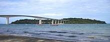
| Koh Puos | Snake Island | កោះពស់ | Île Coudée | 1.1 km2 | |
| Koh Dek Koul (Pae) | (Port) Nail Island | កោះដែកគោល | Rocher Carré | 0.5 km2 |  |
| Koh Russei | Bamboo Island | កោះឫស្សី | Ile Sud-Ouest | 1.4 km2 | |
| Koh Ta Kiev | Ancestor Kiev Island | កោះតាគៀវ | Ile de la Baie | 6.7 km2 |  |
| Koh Kaong Kang/Tass | Mangrove/Disk Island | កោះកោងកាង/ថាស | Ile des Paletuviers | 0.9 km2 |  |
| Koh Traolach | Melon Island | ត្រឡាច | | | |
| Koh Tres/K'teah | Pan Island | កោះខ្ទះ | Ile Ronde | 7.5 ha |  |
| Koh Preab | Dove Island | កោះព្រាប | Île du Départ | 1.0 ha | 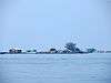 |
| Koh Doung | Coconut Island | កោះដូង | | 1.9 ha | |
| Rocher Thmor | Eiffel Rocks | | Rocher Eiffel | 0.1 ha | |
|
| Name | English Name | Khmer Name | Former French Name | Size | Image |
|
| Koh Thmei | New Island | កោះថ្មី | Ile du Milieu | 40.3 km2 | |
| Koh Seh | Horse Island | កោះសេះ | Ile a L’eau | 7.7 km2 | |
| Koh Ki | Ki Island | កោះគី | | 2.2 ha | |
| Koh Sramauch | Ant Island | កោះស្រម៉ោច | | 28.6 ha | |
| Koh Sampoch | Meerkat/Ferret island | កោះសំពោច | | 0.5 ha | |
| Koh Dam | Graft island | | | 1.1 km2 | |
|
Islands off Kep
| Name | English Name | Khmer Name | Former French Name | Size | Image |
|
| Koh Angkrang[11] | Weaver ant Island | កោះអង្ក្រង | Ile des Fourmis | 6.1 ha | |
| Koh Sen | Sen island | | | 8.3 ha | |
| Koh Pou[12] | Pou tree island | កោះពោធិ | Île Pirate du Nord | 32.2 ha | |
| Koh Kras | Dense Island | កោះក្រាស | Île Rocheuse | 2.9 ha | |
| Koh Matei | Kindergarten island | កោះមត្តេយ្យ | | | |
| Koh Makprang | Makprang fruit island | កោះម៉ាកប្រាង | | | |
| Koh Sngout | Dry Island | កោះស្ងួត | | | |
| Koh Kok | Heron/Egret island | កោះកុក | | | |
| Koh Svay | Mango Island | កោះស្វាយ | | 6.3 ha | |
| Koh Tbal | Mill grinder/Mortar Island | កោះត្បាល់ | | 14.7 ha | |
| Koh Thonsay | Rabbit Island | កោះទន្សាយ | Koh Antay | 1.8 km2 |  |
| Roche Rosita[13] | Rosita rock | | Roche Rosita | | |
|
The outer Islands
| Name | English Name | Khmer Name | Former French Name | Size | Image |
|
| Koh Tang | "Legend" or Display island | កោះតាង | | 5.9 km2 | |
| Koh Moul/Tuich | Round/Small Island | កោះមូល | | 1.9 ha | |
| Koh Domloung | Potato Island | កោះដំឡូង | | 46.7 ha | |
| Koh Trangol | Shaved Island | កោះត្រង៉ោល | | 1.0 ha | |
| Koh Thee Moy | First Island | កោះទីមួយ | Îlots Sud-Est | 2.0 ha | |
| Koh Thee Pee | Second Island | កោះទីបីរ | Îlots Sud-Est | 5.4 ha | |
| Koh Doung | Coconut Island | កោះដូង | | 8.3 ha | |
| Koh Pring | Jambul Island | កោះព្រីង | ile Prins | 0.7 km2 | |
| Koh Poulo Wai 1 | Poulo Wai islands | កោះពូលូវៃ | | 2.1 km2 | |
| Koh Poulo Wai 2 | Poulo Wai islands | កោះពូលូវៃ | | 1.7 km2 | |
| Ilot Veer | Crawl islet | | | 6.2 ha | |
| Koh Veal | Field island | កោះវាល | | 51,016.88 m2 | |
|
Maps
Cambodia's islands - northern part Cambodia's islands - southern part References
- ↑ "List of Islands". Cambodia islands – Island Species Cambodia. Retrieved May 16, 2015.
- ↑ "Sihanoukville". GeoNames. Retrieved May 16, 2015.
- ↑ "SOUTH CHINA SEA AND THE GULF OF THAILAND - SAILING DIRECTIONS p.179" (PDF). NATIONAL GEOSPATIAL-INTELLIGENCE AGENCY. May 1, 2014. Retrieved June 7, 2016.
- ↑ "SOUTH CHINA SEA AND THE GULF OF THAILAND - SAILING DIRECTIONS p.184" (PDF). NATIONAL GEOSPATIAL-INTELLIGENCE AGENCY. May 1, 2014. Retrieved June 7, 2016.
- ↑ "Ilot Nord / Kaôh Mano / North Island, Cambodia". Geody. Retrieved May 22, 2016.
- ↑ "Roche du Branle-bas Cambodge SOURCE National Geospatial-Intelligence Agency, Bethesda, MD, USA". Geomondiale. Retrieved May 22, 2016.
- ↑ "Îlots de la Comète, Cambodia". Geody. Retrieved May 22, 2016.
- ↑ "Kaôh Sănchaura". Mapcarta. Retrieved June 21, 2016.
- ↑ "Île du Milieu". Geody. Retrieved May 22, 2016.
- ↑ "Île Nord-Ouest". Geody. Retrieved May 22, 2016.
- ↑ "Ile des Fourmis: Cambodge SOURCE: National Geospatial-Intelligence Agency, Bethesda, MD, USA". Geomondiale. Retrieved May 22, 2016.
- ↑ "Ile Pirate du Nord". Myfishmaps. Retrieved May 22, 2016.
- ↑ "Search maps for roche rosita". Getamap. Retrieved May 22, 2016.

