List of historic places in Golden Horseshoe
This is a list of historic places in Golden Horseshoe, the region of Ontario on the northwestern and western shores of Lake Ontario. It contains heritage sites listed on the Canadian Register of Historic Places (CRHP), all of which are designated as historic places either locally, provincially, territorially, nationally, or by more than one level of government. The following areas have been separated out due to their many listings:
List of historic places in other parts of the region
Regional Municipality of Durham
| Name | Address | Coordinates | IDF | IDP | IDM | Image | |
|---|---|---|---|---|---|---|---|
| Former Bowmanville Boys Training School/Camp 30 National Historic Site of Canada | 2020 Lambs Road, Bowmanville, ON | 43°55′43″N 78°39′59″W / 43.9285°N 78.6663°W | 19684 |  | |||
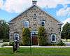
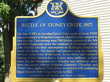
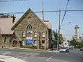
| Old Stone Church National Historic Site of Canada | 1490 Road 15 (Simcoe Street), Brock (Beaverton), ON | 44°25′35″N 79°06′57″W / 44.4264°N 79.1157°W | 7775 |  More images | |||
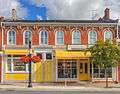
| 19 King Street East | 19 King Street East, Clarington, ON | 43°54′42″N 78°41′19″W / 43.9118°N 78.6885°W | 7577 | | |||
| 210 King Street West | 210 King Street West, Clarington, ON | 43°55′00″N 78°35′34″W / 43.9167°N 78.5928°W | 7592 | | |||
| 62-66 King Street West | 62-66 King Street West, Clarington, ON | 43°54′46″N 78°41′28″W / 43.9127°N 78.6911°W | 7602 | | |||
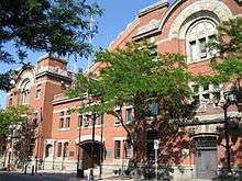
| Colonel R. S. McLaughlin Armoury | 53 Simcoe Street North, Oshawa, ON | 43°53′57″N 78°51′49″W / 43.8992°N 78.8637°W | 4801 | | |||
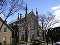
| Parkwood National Historic Site of Canada | 270 Simcoe Street North, Oshawa, ON | 43°54′17″N 78°52′03″W / 43.9048°N 78.8676°W | 4300 | 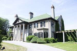 More images | |||
| Art Gallery; Former Brougham School House | 1613 Highway 7, Pickering, ON | 43°55′03″N 79°06′35″W / 43.9176°N 79.1098°W | 13335 | 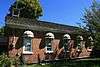 | |||
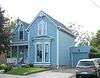
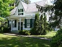
| Bentley House | 3590 Brock Road, Pickering (Brougham), ON | 43°55′06″N 79°06′24″W / 43.9184°N 79.1068°W | 9836 | 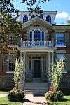 More images | |||
| Former Atha School House | 555 8th Concession Road, Pickering, ON | 43°56′32″N 79°10′47″W / 43.9421°N 79.1796°W | 13092 |  | |||
| Former Commercial Hotel | 1709 Highway 7 Road, Pickering Airport Lands, Pickering (Brougham), ON | 43°55′08″N 79°06′18″W / 43.919°N 79.105°W | 12992 | 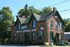 | |||
| Former Miller Residence | 1622 Highway 7 Road, Pickering (Brougham), ON | 43°55′05″N 79°06′38″W / 43.9181°N 79.1105°W | 13041 |  | |||
| Former Mount Pleasant School House | 1503 7th Concession Road, Pickering, ON | 43°56′07″N 79°07′29″W / 43.9354°N 79.1247°W | 13088 |  | |||
| Former Pickering Town Hall | 3545 Brock Road, Pickering, ON | 43°55′04″N 79°06′22″W / 43.9179°N 79.106°W | 13152 |  | |||
| Thistle Ha' Farm National Historic Site of Canada | Concession and Brock Roads, Pickering, ON | 43°56′35″N 79°06′28″W / 43.9431°N 79.1079°W | 9632 |  More images | |||
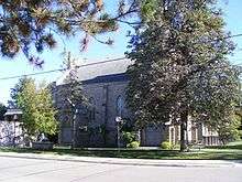
| Former Port Perry Town Hall National Historic Site of Canada | 302 Queen Street, Scugog, ON | 44°06′12″N 78°56′50″W / 44.1034°N 78.9472°W | 4211 | 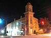 More images | |||
| Leaskdale Manse National Historic Site of Canada | Just north of St. Paul's Presbyterian Church on Durham Regional Rd., Uxbridge, ON | 44°12′11″N 79°09′38″W / 44.2031°N 79.1606°W | 7716 | 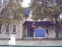 More images | |||
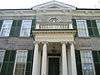
| Ontario County Court House | 416 Centre Street South, Whitby, ON | 43°52′32″N 78°56′38″W / 43.8756°N 78.9438°W | 10545 |  More images |
Regional Municipality of Halton


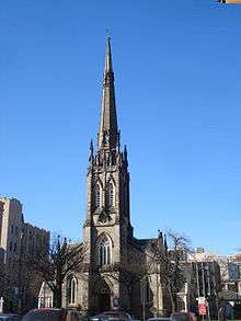
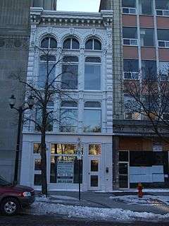
Hamilton


.jpg)


See also
| Wikimedia Commons has media related to Cultural heritage monuments in Ontario. |
References
This article is issued from
Wikipedia.
The text is licensed under Creative Commons - Attribution - Sharealike.
Additional terms may apply for the media files.